A³-team @ ATom
Austrian Airborne Aerosol Measurements at Atmospheric Tomography Mission (ATom)
The NASA-sponsored ATom airborne field experiment investigates how human emissions affect air quality and climate change in the atmosphere by making measurements with the DC-8 research aircraft that will fly from near the North Pole down the middle of the Pacific Ocean, to the edge of Antarctica and back up the Atlantic Ocean.
![]()
In this photo blog, we – Bernadett Weinzierl, Maximilian Dollner and Harald Schuh – report about the preparations for ATom and our measurements during the first ATom deployment in summer 2016. Weekly updates about specific aspects of our measurements will be given in the uni:view magazine. Details about the project including a detailed project description, participants and mission calendar can be found on the ATom project homepage.
Contact: Univ.-Prof. Dr. Bernadett Weinzierl
24-26 August 2016: Bye, bye ATom-1 – see you soon for ATom-2
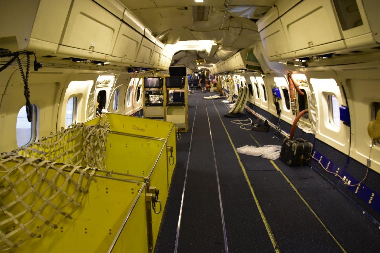
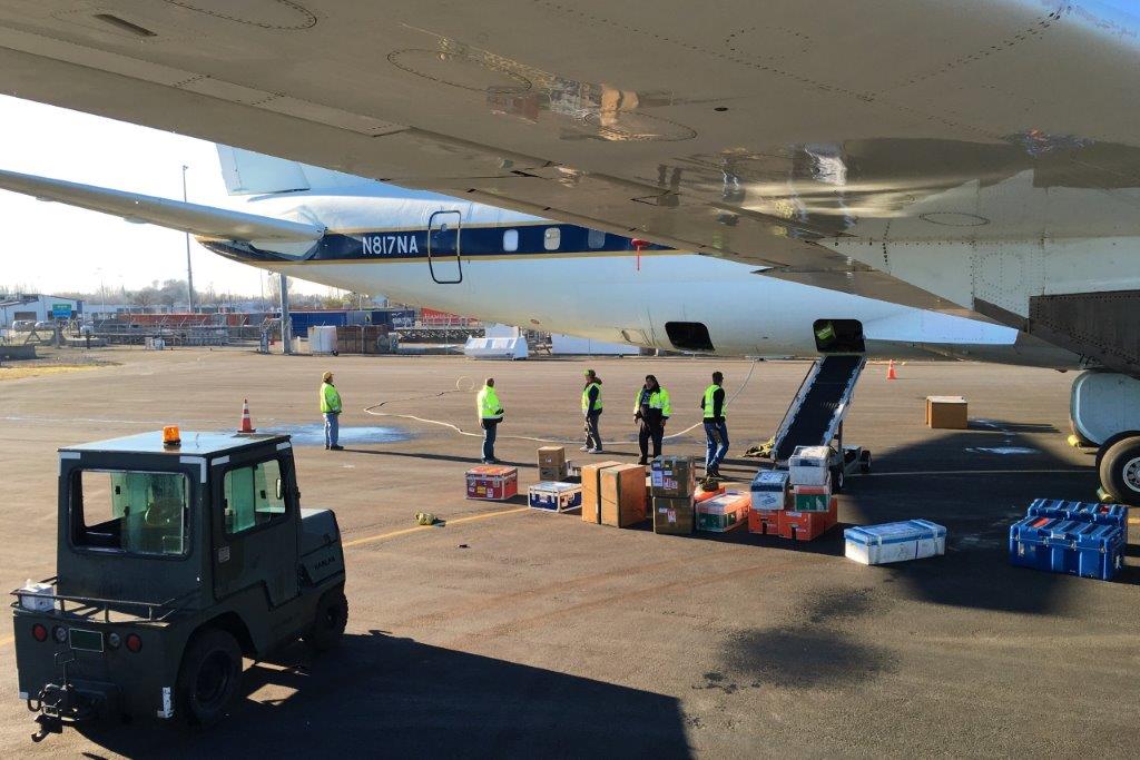
Whereas integration of the instruments into the DC-8 research aircraft for the ATom-1 mission took more than 4 weeks, almost everything is downloaded from the aircraft in a few hours only (top left and right photograph). Two days after returning to Palmdale, the DC-8 is empty, instruments are packed into boxes ready for shipping back to the individual research institutes. Now we have a short break until upload for ATom-2 will start in December 2016.
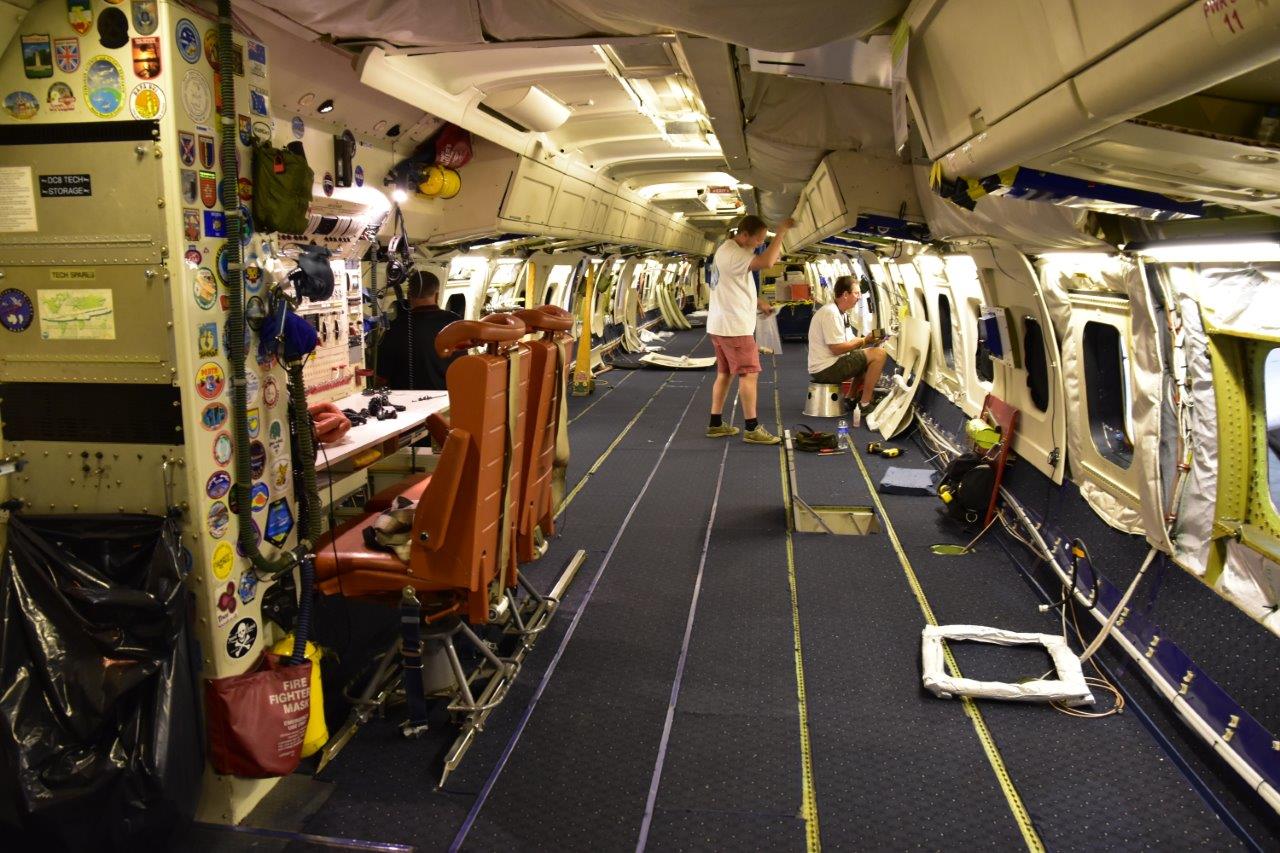

23 August 2016: A great field experiment ends
After more than three weeks of touring around the world and two month abroad, a great field experiment ends today. 27 scientists and 15 crew members were flying from Palmdale towards the North Pole, down the middle of the Pacific Ocean, to the edge of Antarctica and back up the Atlantic Ocean. We crossed 15 time zones, measured 147 vertical profiles, and visited nine different locations. Now we have a very exciting and unique data set which will keep us busy for a long time.
Shortly before landing in Palmdale, California.
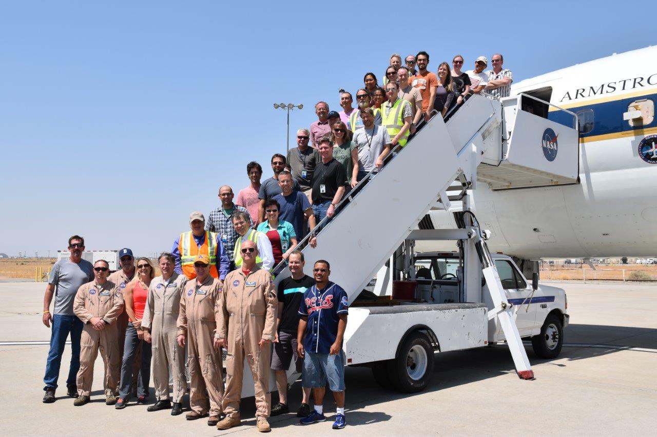
Part of the ATom-1 team after arrival in Palmdale on 23 August 2016.
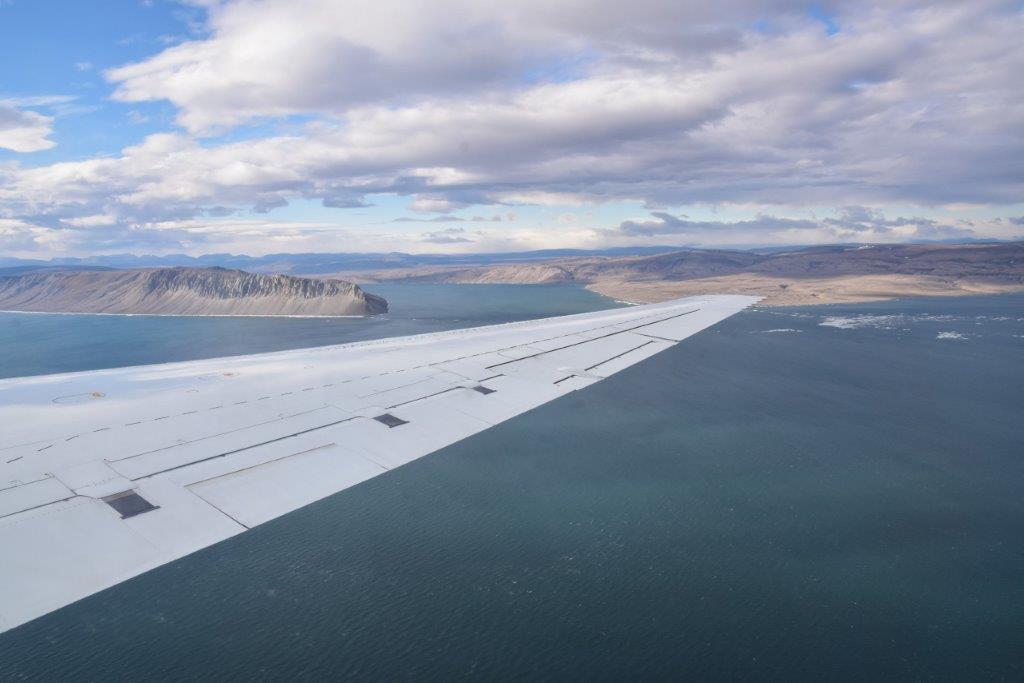
22 August 2016: Almost home
The second to last flight of the Atom-1 deployment leads us from Kangerlussuaq, Greenland, to Minneapolis. After being away from major towns for several weeks, staying next to the “Mall of America” is a big change for all of us.

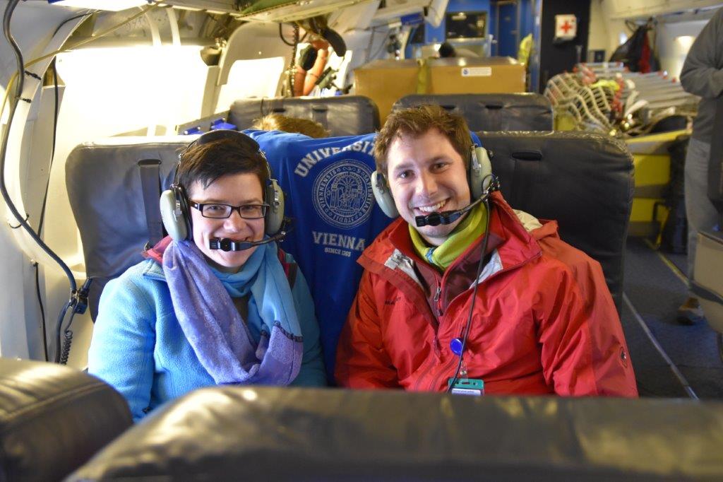
In the cockpit of the DC-8.
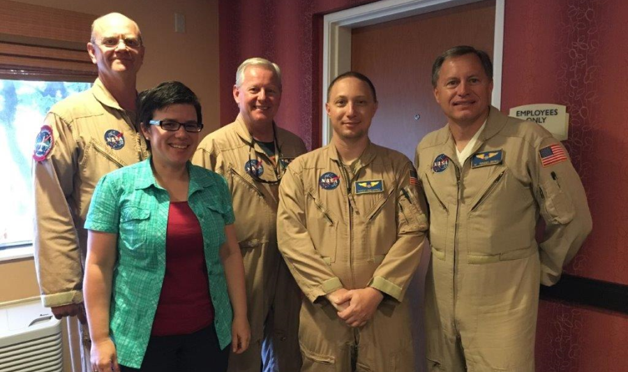
Bernadett Weinzierl together with the pilots, the navigator and the flight engineer of the DC-8.
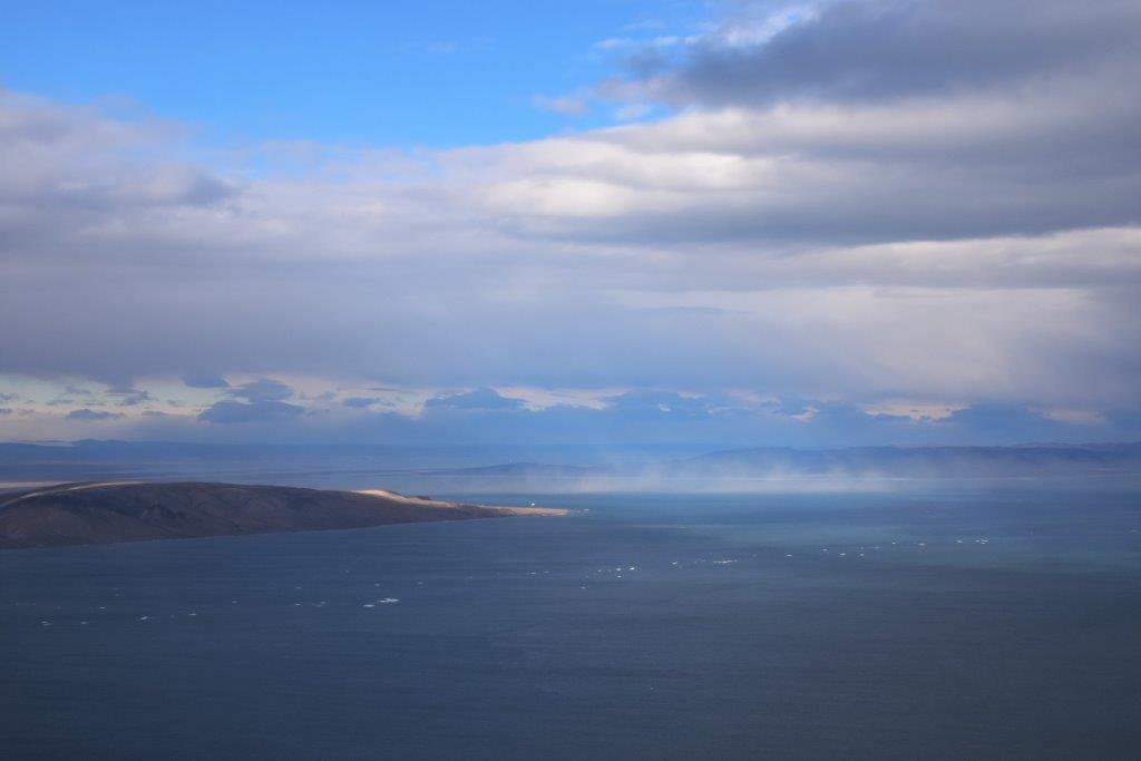
21 August 2016: Green Greenland
After calibrating CAPS in the morning, we enjoyed sunny Kangerlussuaq, Greenland, at temperatures around 17°C in the afternoon.
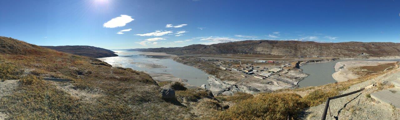
The airport of Kangerlussuay seen from a hill south-east of Kangerlussuaq.
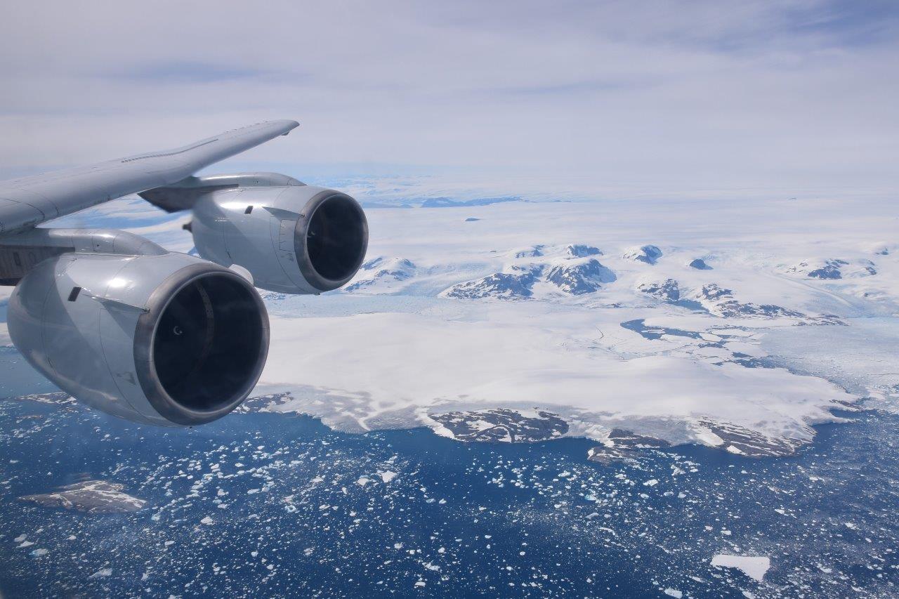
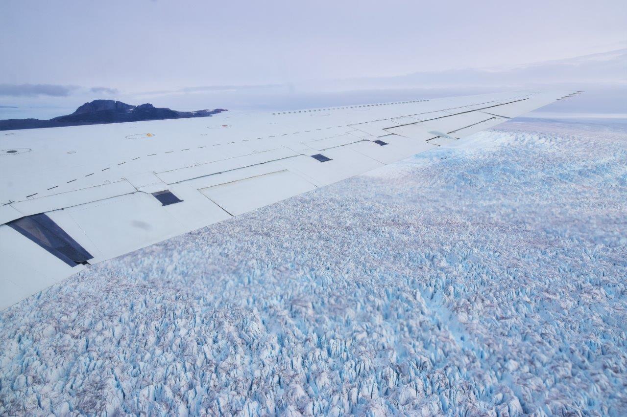
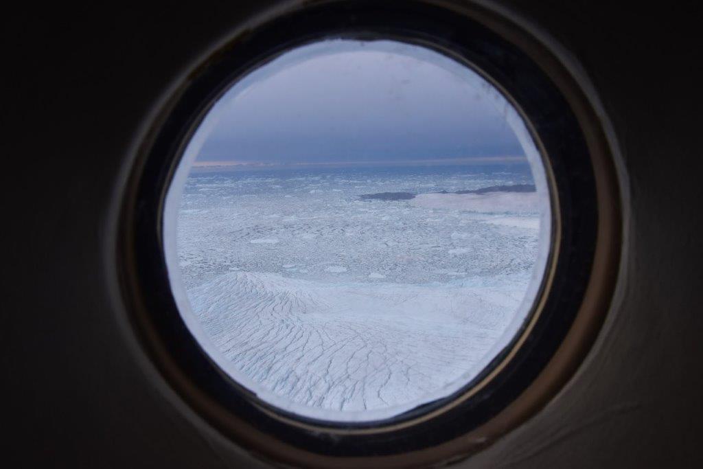
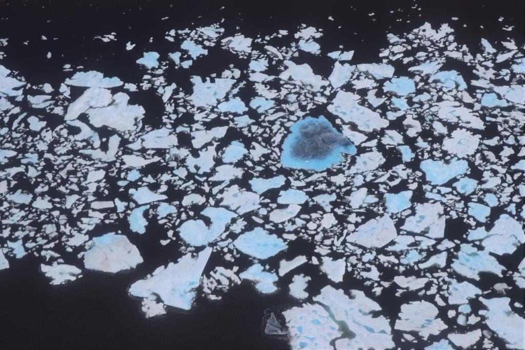
20 August 2016: The fascination of ice
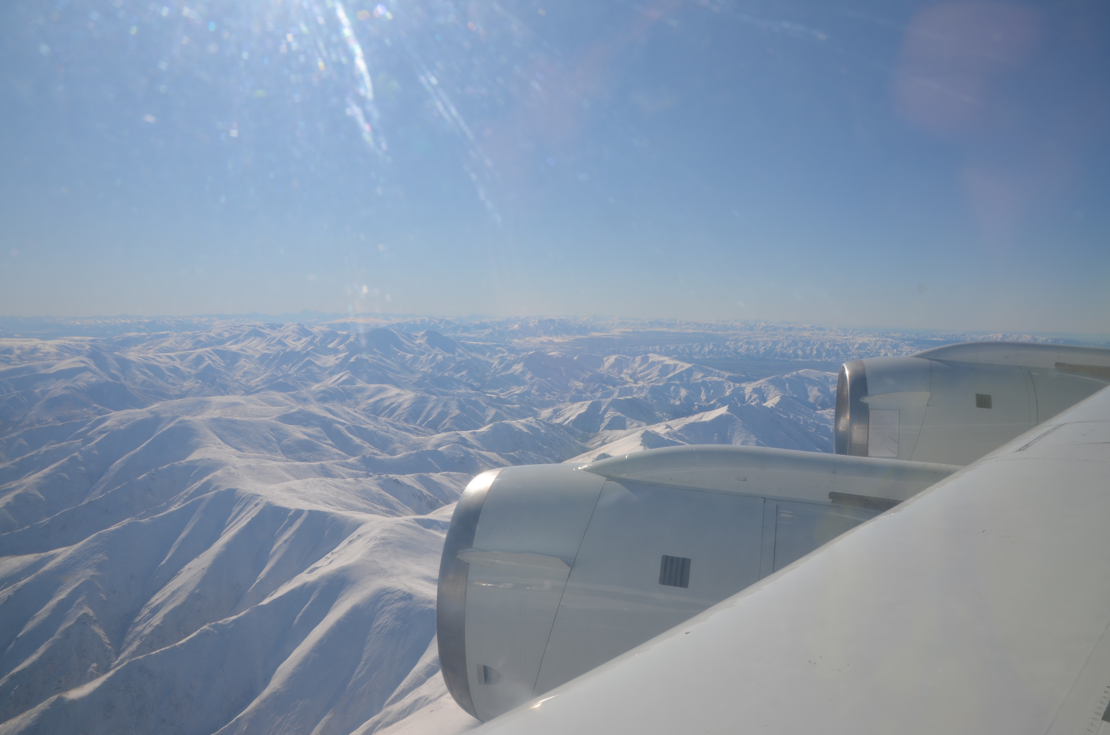
Today, we had one of the most scenic flights of ATom-1. We left the Azores at 9 a.m., flew towards Greenland and continued to Eureka – the northernmost weather station of the Earth. After about 10 hours of flight time, 16 vertical profiles between 0.2 and 12 km, measurements in pollution layers, water and ice clouds, we landed in Kangerlussuaq, Greenland. Flying at 200 m above the Greenlandic ice shield and over the sea gave us amazing views of glaciers and ice bergs. Around Eureka, almost no ice was present.


19 August 2016: Azores – a short stop-over in Europe
Two days on the Azores give us time for calibrations and a science meeting: the ATom-1 data set promises a lot of exciting research!
17 August 2016: From the southern to the northern hemisphere
After an early morning take-off in Ascension Island, we measured African biomass burning aerosol in the southern hemisphere, crossed the equator and the intertropical convergence zone (ITCZ), and found lots of dust off the coast of Africa. Around 5 p.m., we reached the Azores.
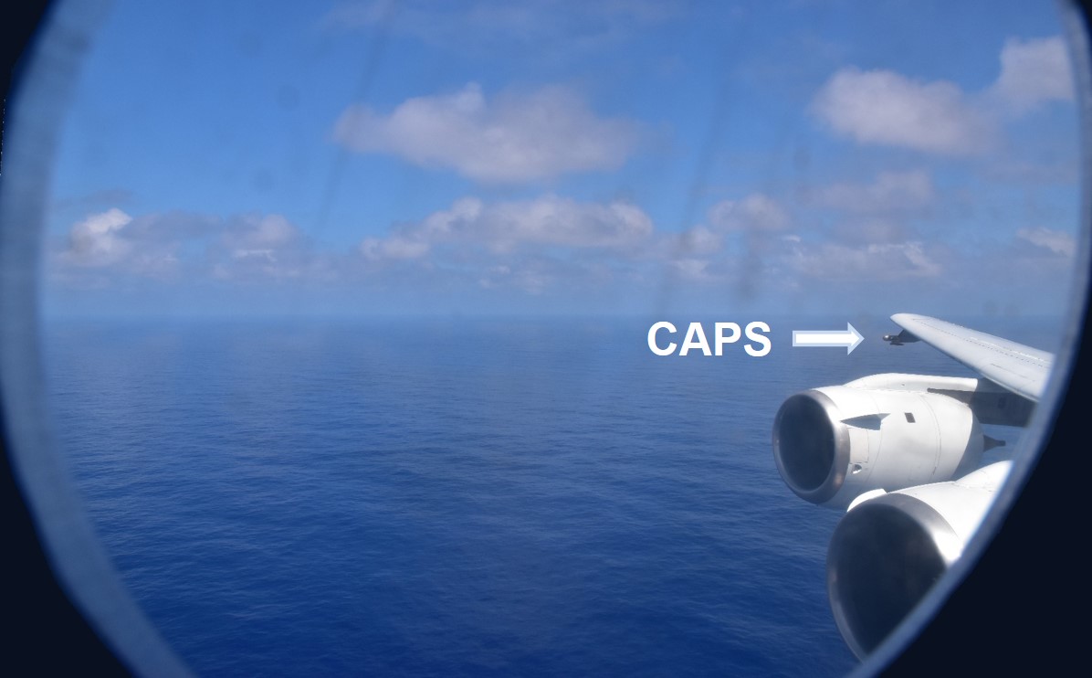
The DC-8 on Terceira, Azores. Our CAPS instrument is mounted at the right wing tip.
15 August 2016: Completing the U-turn – next stop Ascension Island
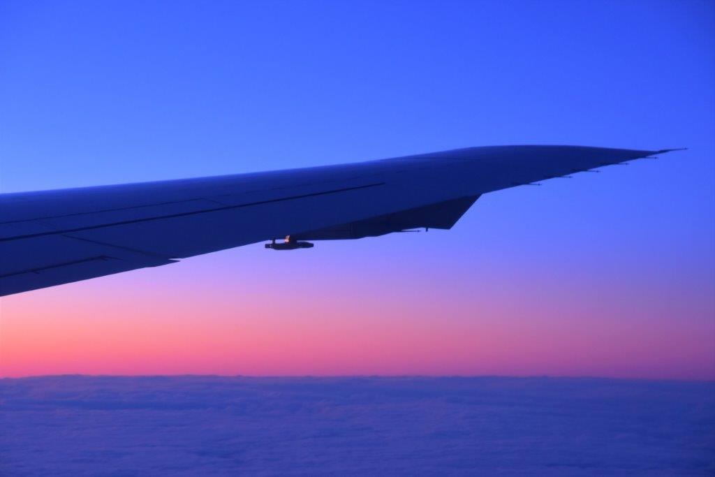
An early morning take-off in Chile rewarded us with a beautiful sunrise on the DC-8. During the 9.5-hour flight from Chile to Ascension Island which is located in the middle of the southern Atlantic, we detected many biomass burning aerosol layers from different origins.

Sunrise seen from the cockpit of the DC-8
The CAPS instrument in the early morning sun over the southern Atlantic Ocean
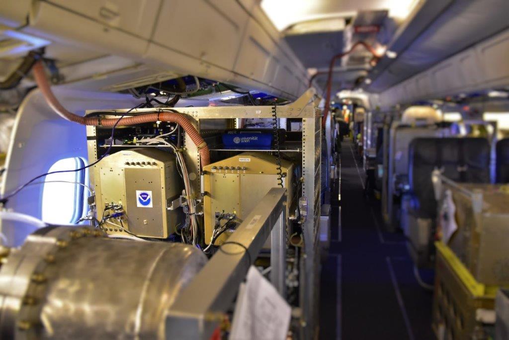
The CAPS data acquisition system is mounted in the upper part of the NOAA aerosol microphysics measurement system
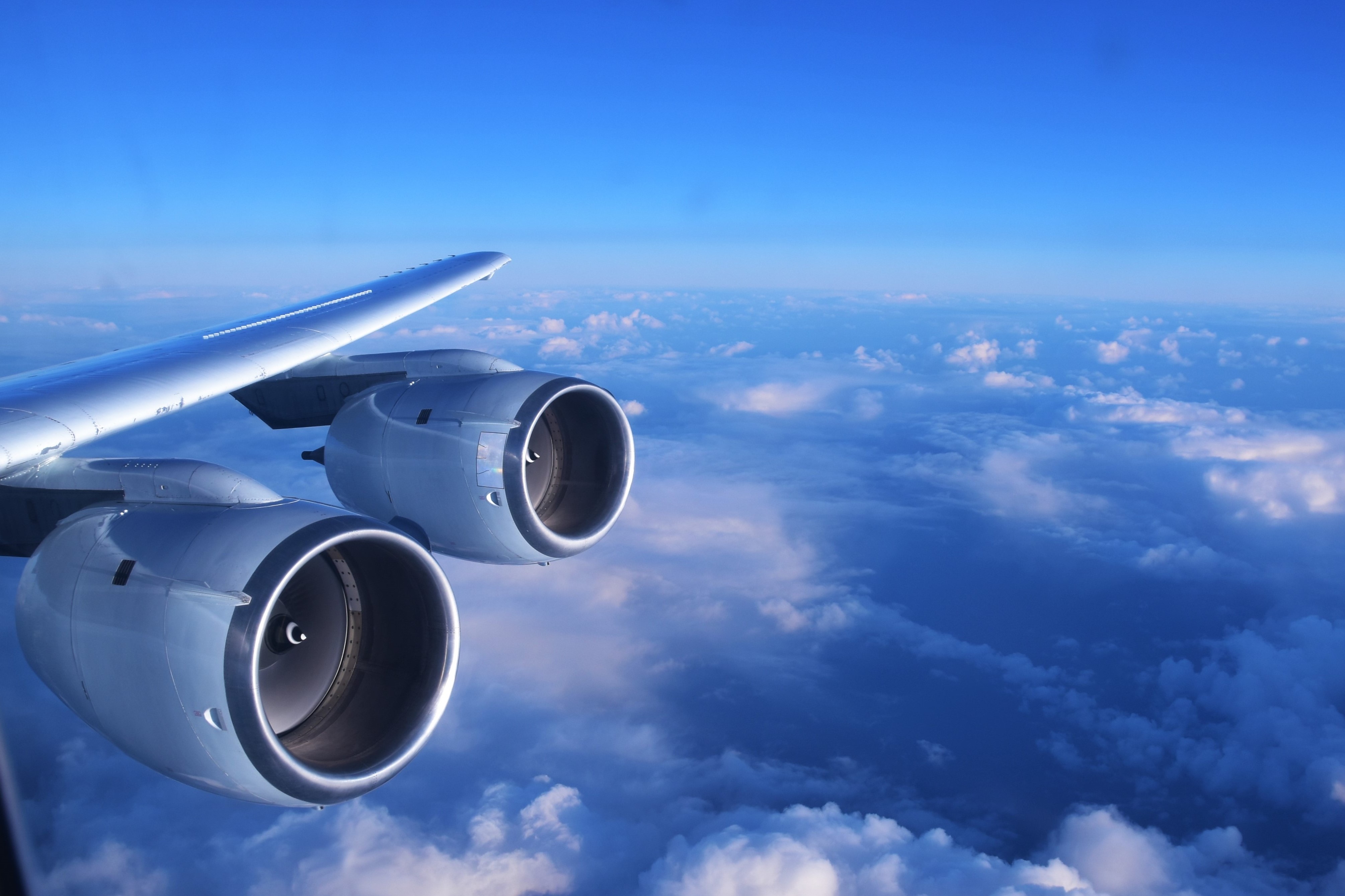
Left engines of the DC-8. At the horizon, a thin biomass burning aerosol layer is visible
14 August 2016: Chilly in Chile
Today we calibrated CAPS and analyzed preliminary data. Temperatures were freezing cold and calibration took much longer than usual.

Punta Arenas, Chile, is located at the Strait of Magellan
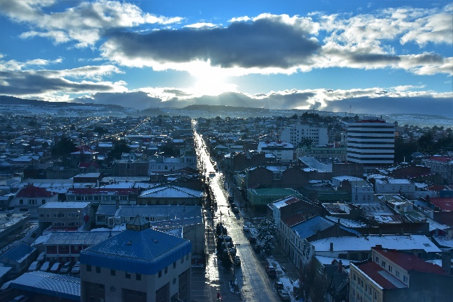
View over the City of Punta Arenas, Chile
13 August 2016: Today, tomorrow, or still yesterday?
During the ATom flights we are facing regular time zone changes. Today we were flying into the past: we left Christchurch, New Zealand, at 10:15 and arrived after about ten hours of flight time in Punta Arenas, Chile, at 4:55 in the morning of the same day. Thereby, 13 August turned into a 38-hour day for the DC-8 crew. For parts of the flights, in particular down the southern Ocean towards Antarctica, temperatures were as low as -70 degrees Celsius in the upper troposphere above 9-10 km altitude.
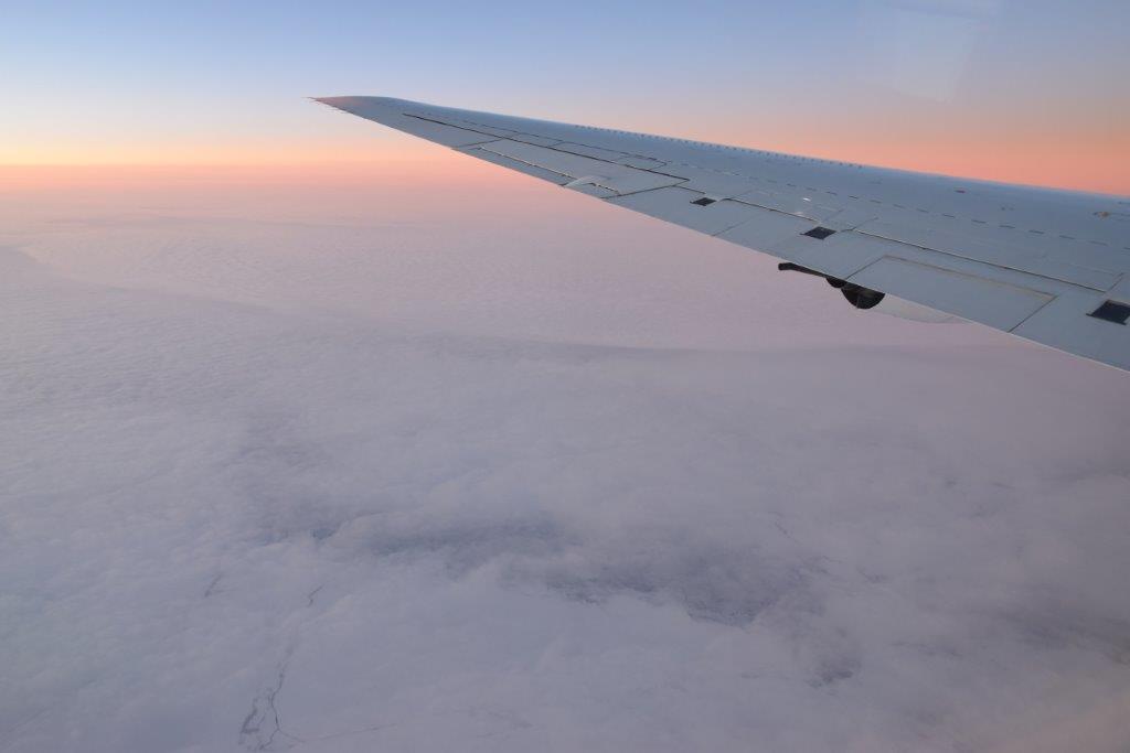
Sunset over the Southern Ocean between New Zealand and Antarctica. Pack ice is visible below the cloud layer.
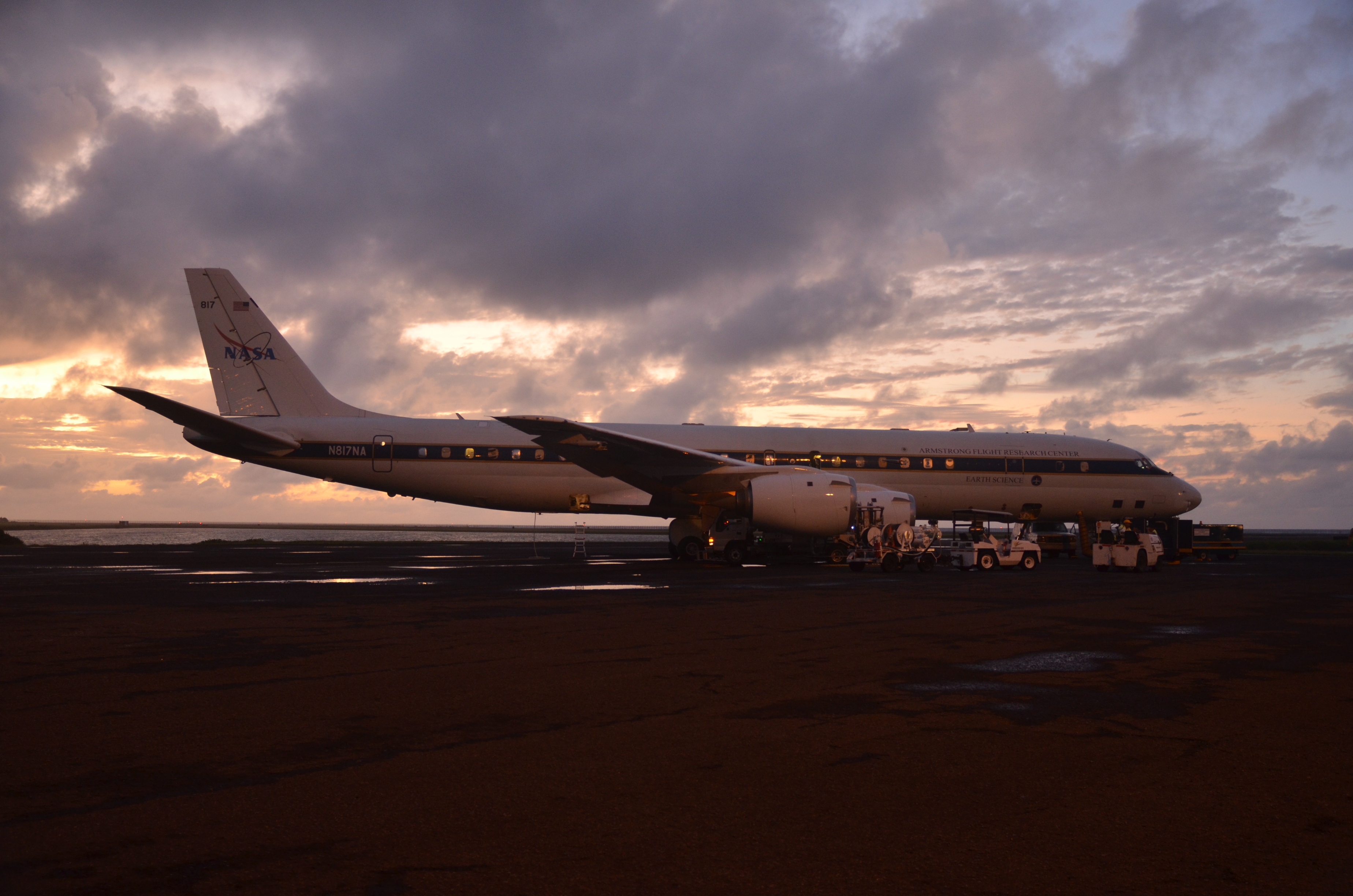
The DC-8 after arrival at Punta Arenas, Chile
10 August 2016: Kia ora – hello from Christchurch, New Zealand!
The first part of the first ATom deployment (ATom-1) ends in Christchurch, New Zealand. Here, we have four days for extended instrument servicing, calibrations, and data analysis. For most of the scientific teams, also the crew change takes place in New Zealand.
Bernadett Weinzierl (left) and Maximilian Dollner (right) in the DC-8
Loading equipment for the second part of the first ATom deployment onto the DC-8
9 August 2016: A typical ATom flight
In the third article at uni:view, we describe pre-flight preparations, typical procedures and observations during a research flight, as well as post-flight work.
8 August 2016: Journey through the time
We left American Samoa early in the morning for a 7- to 8-hour flight. On our way down to Christchurch, New Zealand, we crossed the international dateline, skipped an entire day, and landed one day later. Although the measurements were taken in the remote Pacific, we still found elevated aerosol layers.
DC-8 before take-off at Pago Pago, American Samoa
Approaching the South Island of New Zealand
6 August 2016: Crossing the Intertropical Convergence Zone (ITCZ)
On our flight from Kona, Hawaii, to Pago Pago, American Samoa, we crossed the ITCZ. The ITCZ is located near the equator and appears as a band of deep convective clouds. We were happy to find a variety of clouds (including water and ice clouds) between 500 ft above the sea surface and near the stratosphere.
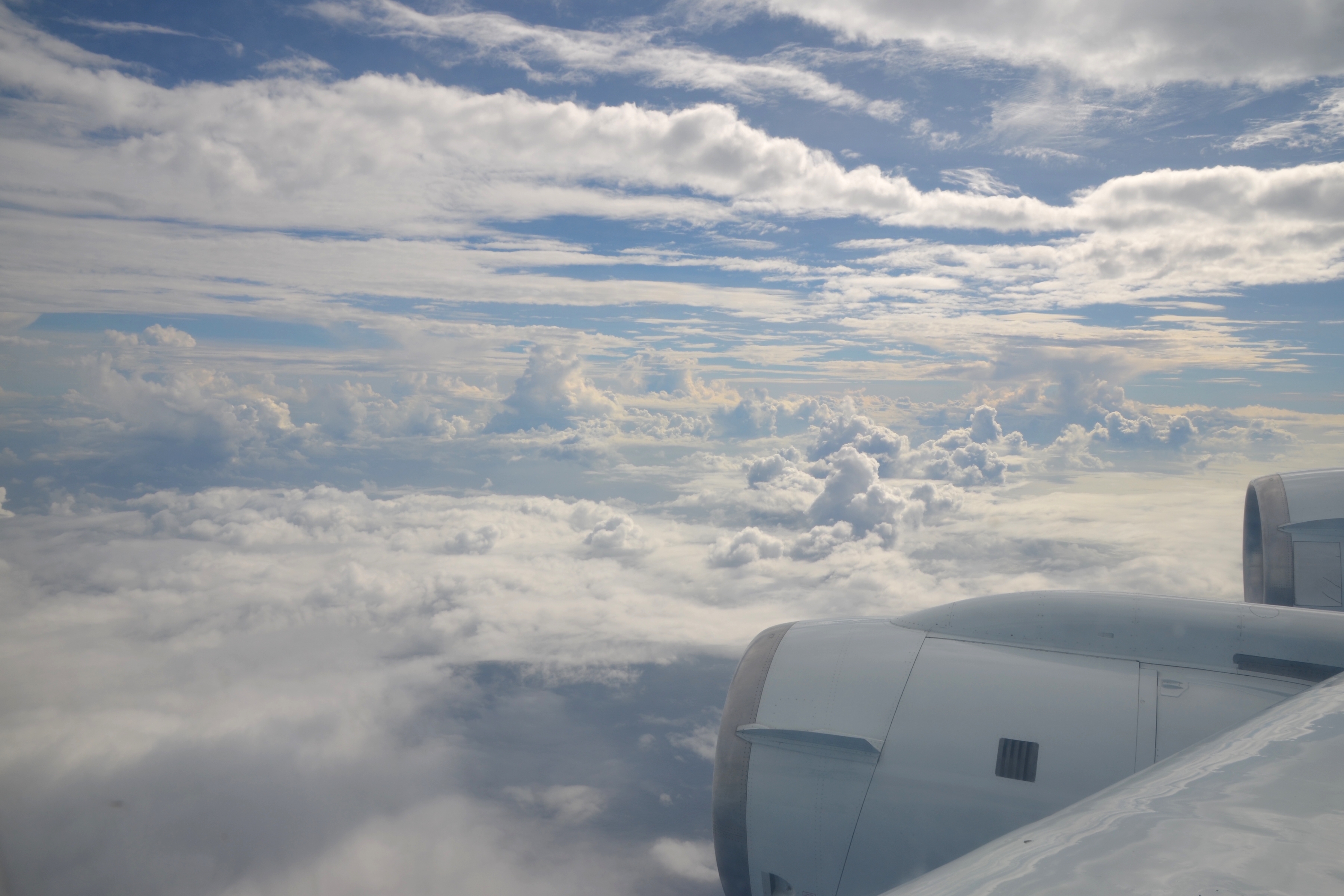
Crossing the ITCZ
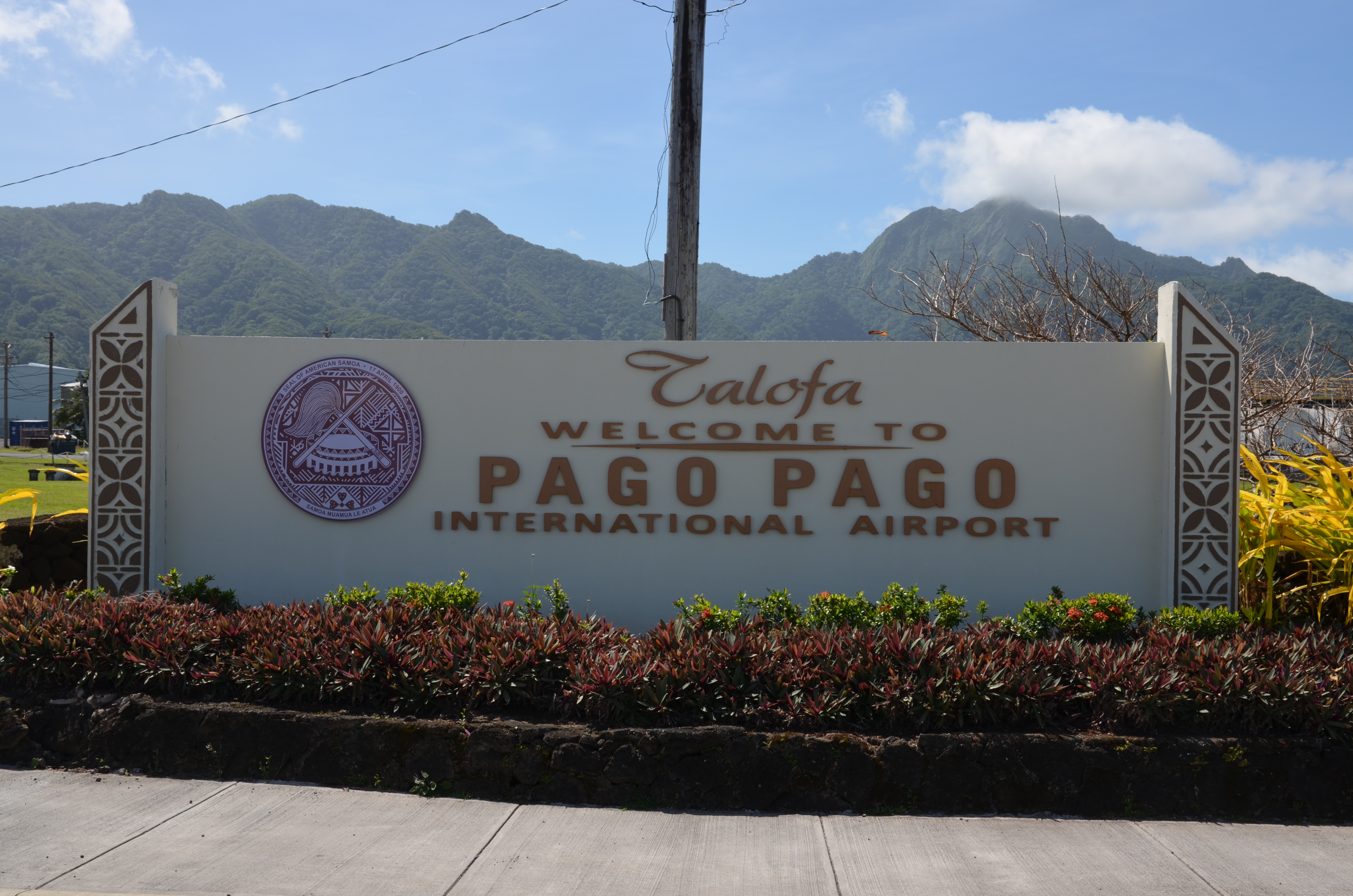
Pago Pago International Airport
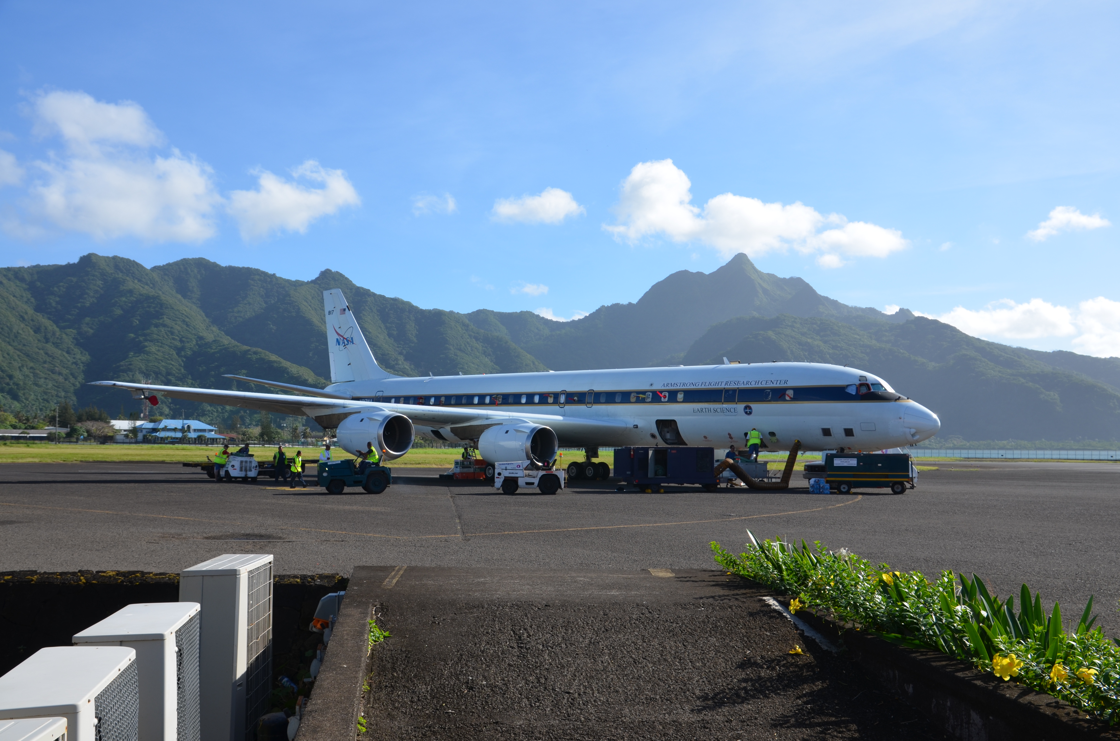
DC-8 parked at American Samoa
5 August 2016: Hawaii – time for calibration and software
A two day stopover gives us time for extensive CAPS calibrations and maintenance as well as time to work on software.
Maximilian Dollner working with the CAPS
CAPS instrument in the early morning sun
3 August 2016: Aloha!
Today, we continued our journey round the world and headed from Anchorage, Alaska, to Kona, Hawaii. First, we overflew the beautiful Alaskan landscape with mountains, glaciers and wet green land while we crossed several cirrus and water clouds. Then we entered the area of the Pacific Ocean where we continued vertical profiling between near the stratosphere and altitudes as low as 500 ft above the sea surface. Finally we landed in Hawaii.
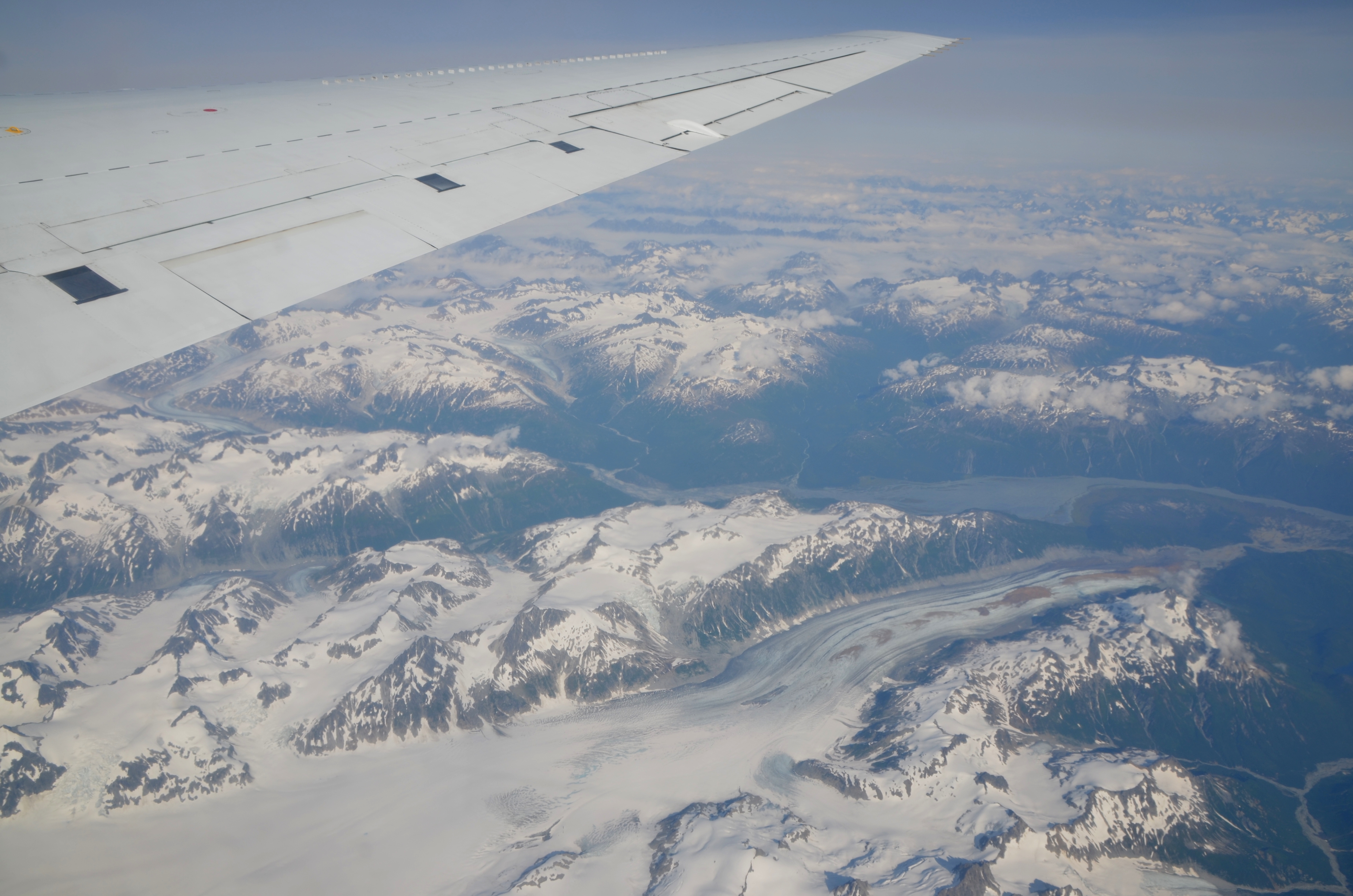
Glaciers in Alaska
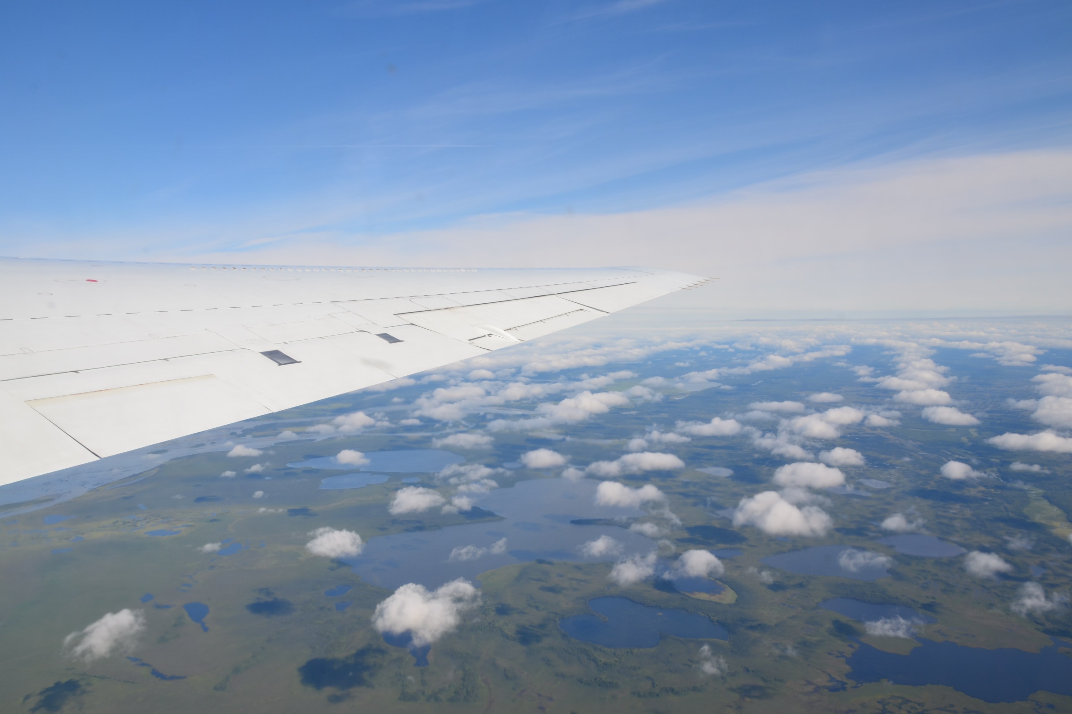
Lakes and green land in Alaska

Sunset at Kona, Hawaii
2 August 2016: Arctic rain
After on month in the dry desert of California, we got a rainy day in Anchorage – definitely not a weather for CAPS calibrations out at the DC-8 wing.

A rainy day in Alaska
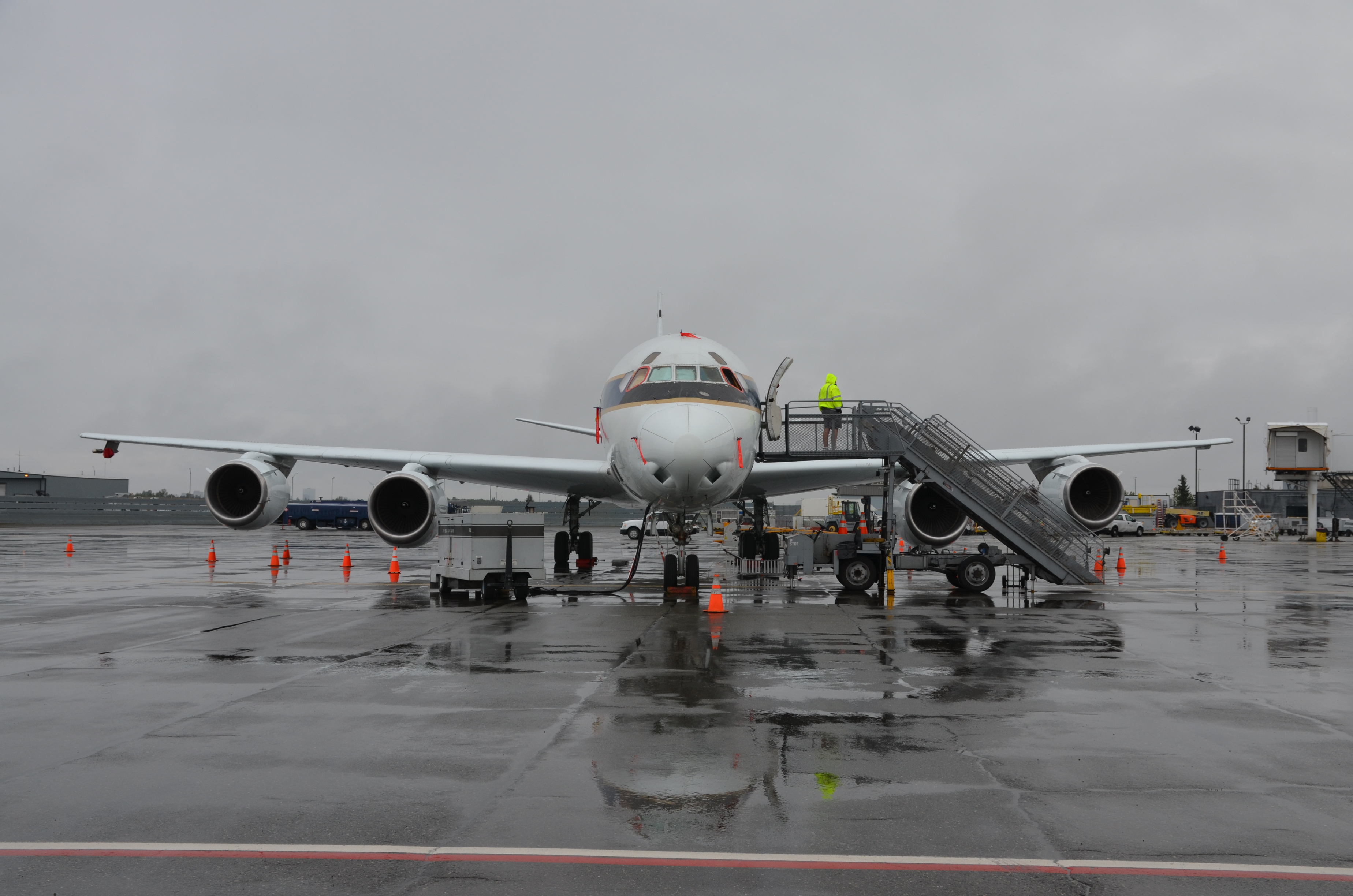
DC-8 in the rain at the airport of Anchorage
1 August 2016: The journey round the world begins
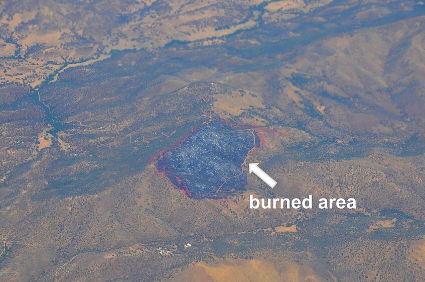
Today, we left for our world tour. Starting from Palmdale, California, we passed a number of bush fires, and overflew several amazing volcanos of the Cascade Volcanic Arc, a section of the Pacific Ring of Fire. Later, we continued to the high Arctic where we were able take measurements at 500 ft above the Beaufort Sea. After roughly ten hours of flight time, we arrived at our first stopover: Anchorage, Alaska.
Forest fires on the way to Anchorage

Flying over the Cascade Volcanic Arc
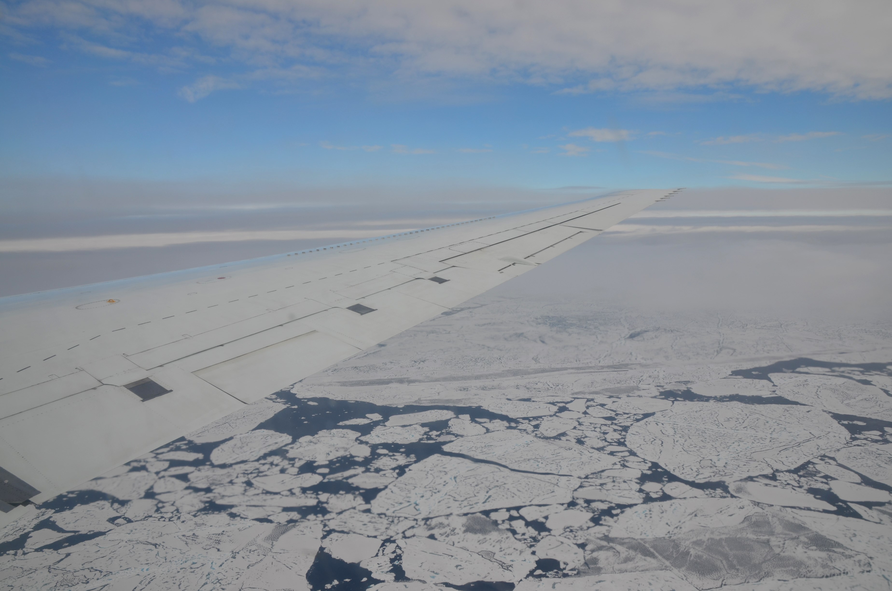
Floating ice sheets in the Beaufort Sea
30 July 2016: The challenges of airborne measurements
Our second article at uni:view summarizes instrument requirements and preparation for airborne measurements, and gives an overview of the the working principle of the CAPS instrument.
29 July 2016: To the equator and back – the first scientific mission flight
Originally planned for 28 July, but then postponed by one day, we had the first scientific mission flight today. After take-off in Palmdale, the 10-hour flight took us down to the equator and back up to Palmdale. We again detected emissions from the huge bush fires in California, found mineral dust – probably originating from the Sahara – and sampled sea salt aerosol at low levels over the Pacific Ocean.
The DC-8 during the preparations for the „equator flight“.
Inlets for trace gas measurements mounted at the fuselage of the DC-8.
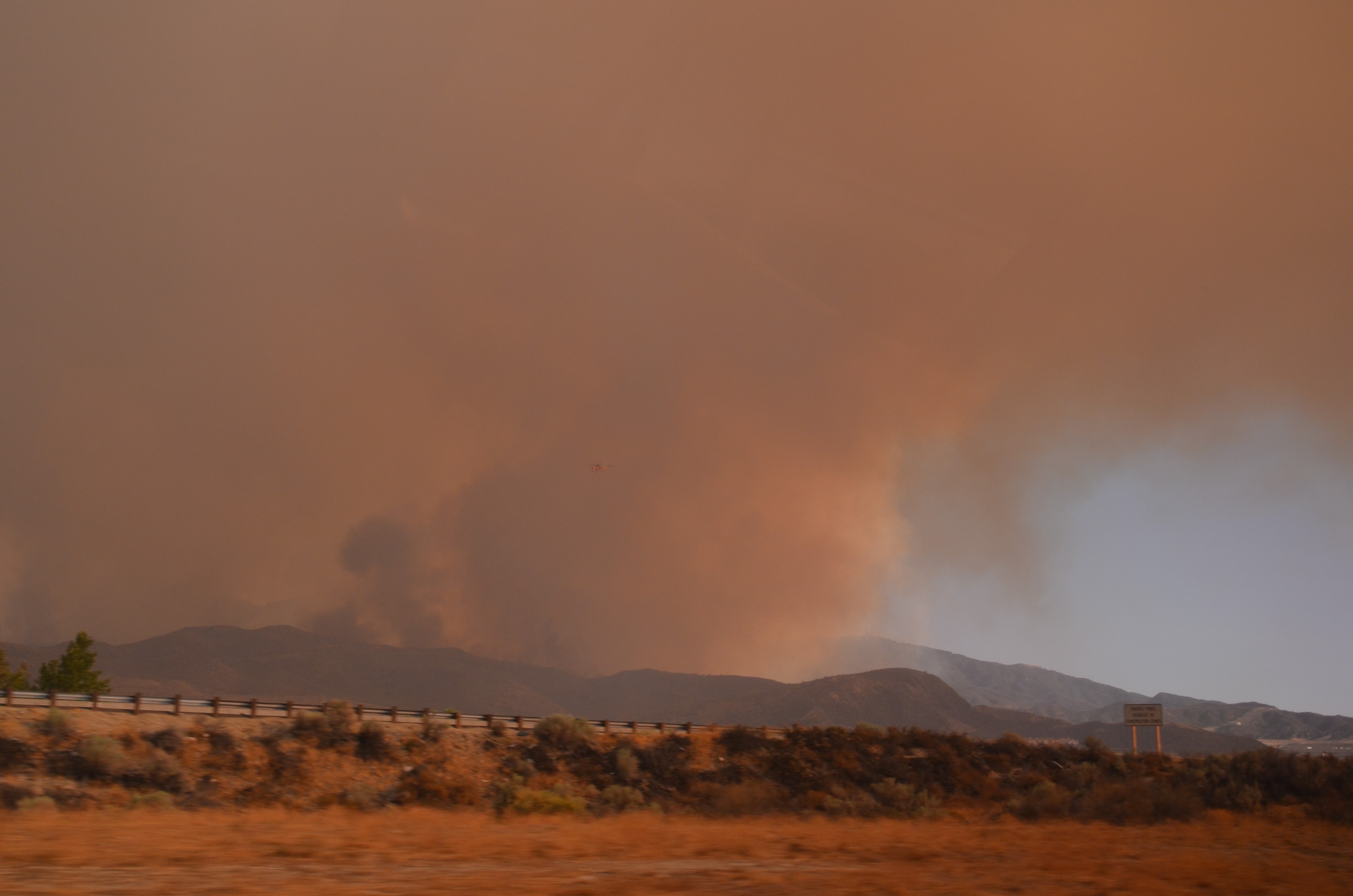
26 July 2016: The countdown is on
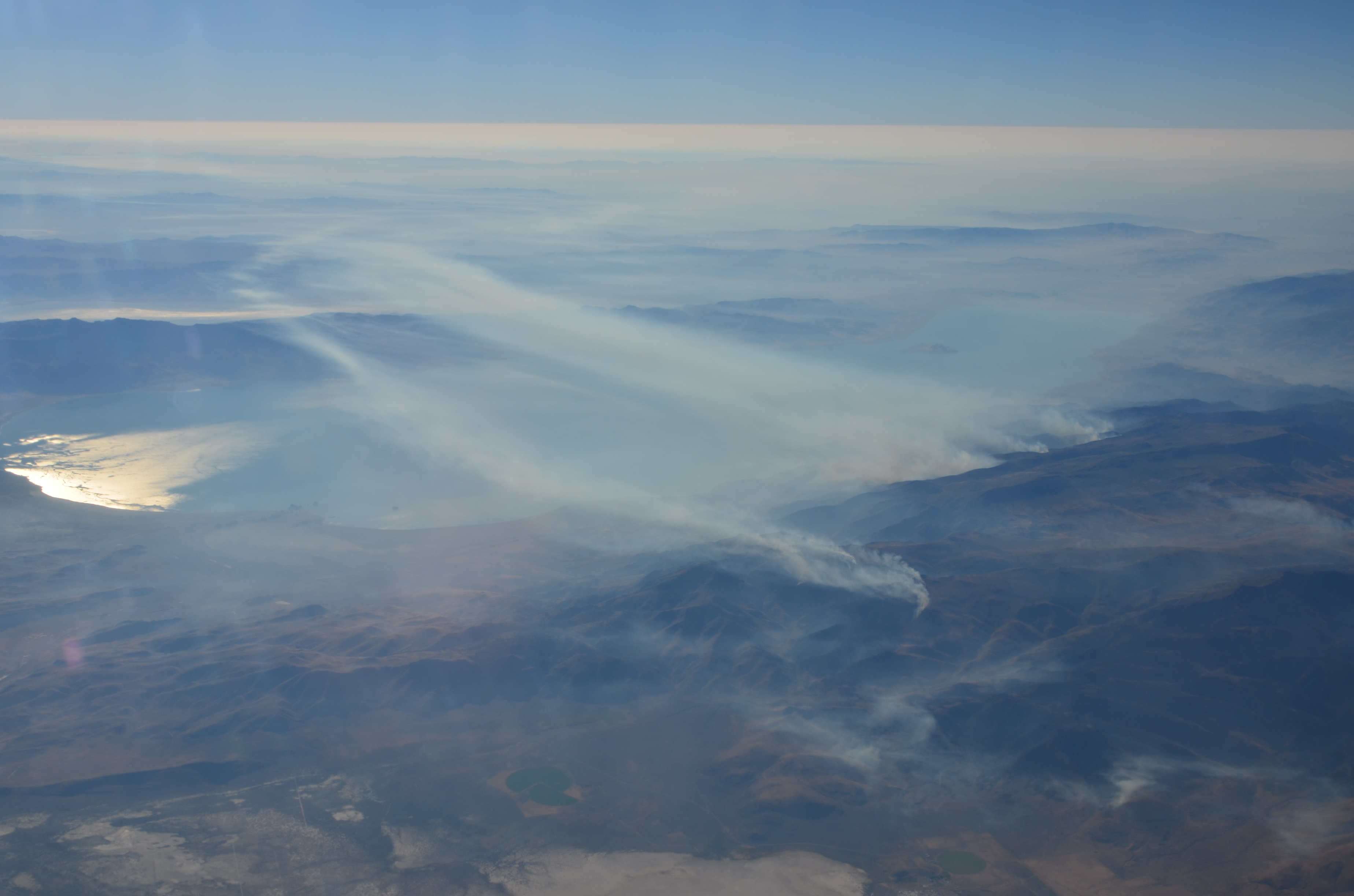
In preparation for the upcoming ATom deployment, a 6.5-hour test flight was performed today. The route took us from Palmdale down south into the area between the two Hurricanes over the eastern Pacific and back to Palmdale. This flight was intended to simulate the ATom-type flight patterns with repeated climbs and descents between 0.2-12 km altitude. During take-off and landing, we collected data of the smoke layers from the huge fires which we saw from the car on 24 July. In addition, we found extended coarse mode aerosol concentrations over the eastern Pacific.

Coast of California
CAPS seen from the front window of the aircraft
CAPS seen from the back of the DC-8
25 July 2016: Remote control for remote places
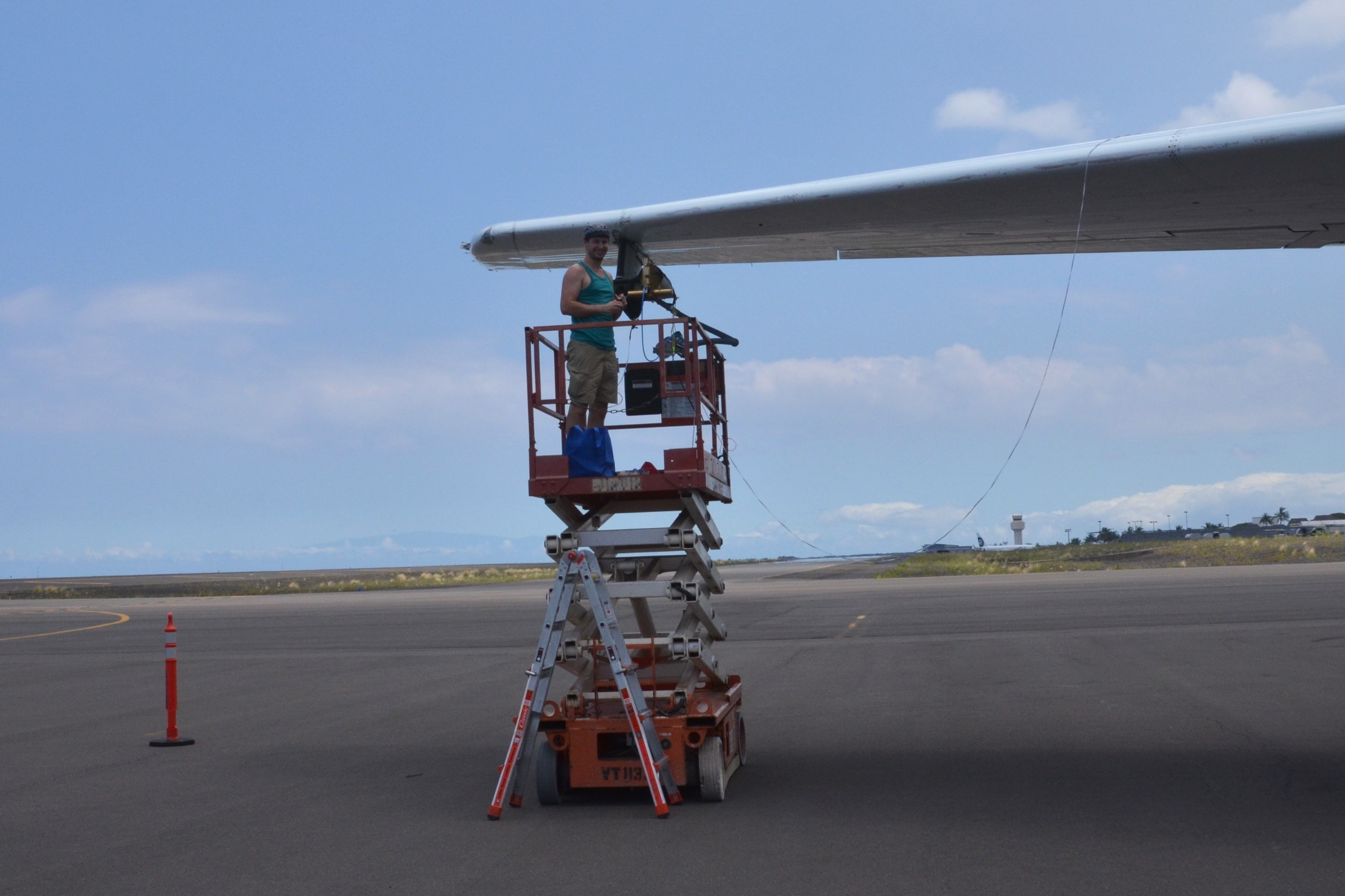
The CAPS instrument is mounted at the DC-8 wing and can only be accessed by a lift or a ladder. The CAPS data acquisition system is installed inside the cabin of the DC-8, roughly 30 m away from the instrument. Via the DC-8 board network and remote control, we are able to operate the CAPS out at the wing from a tablet computer or mobile phone.
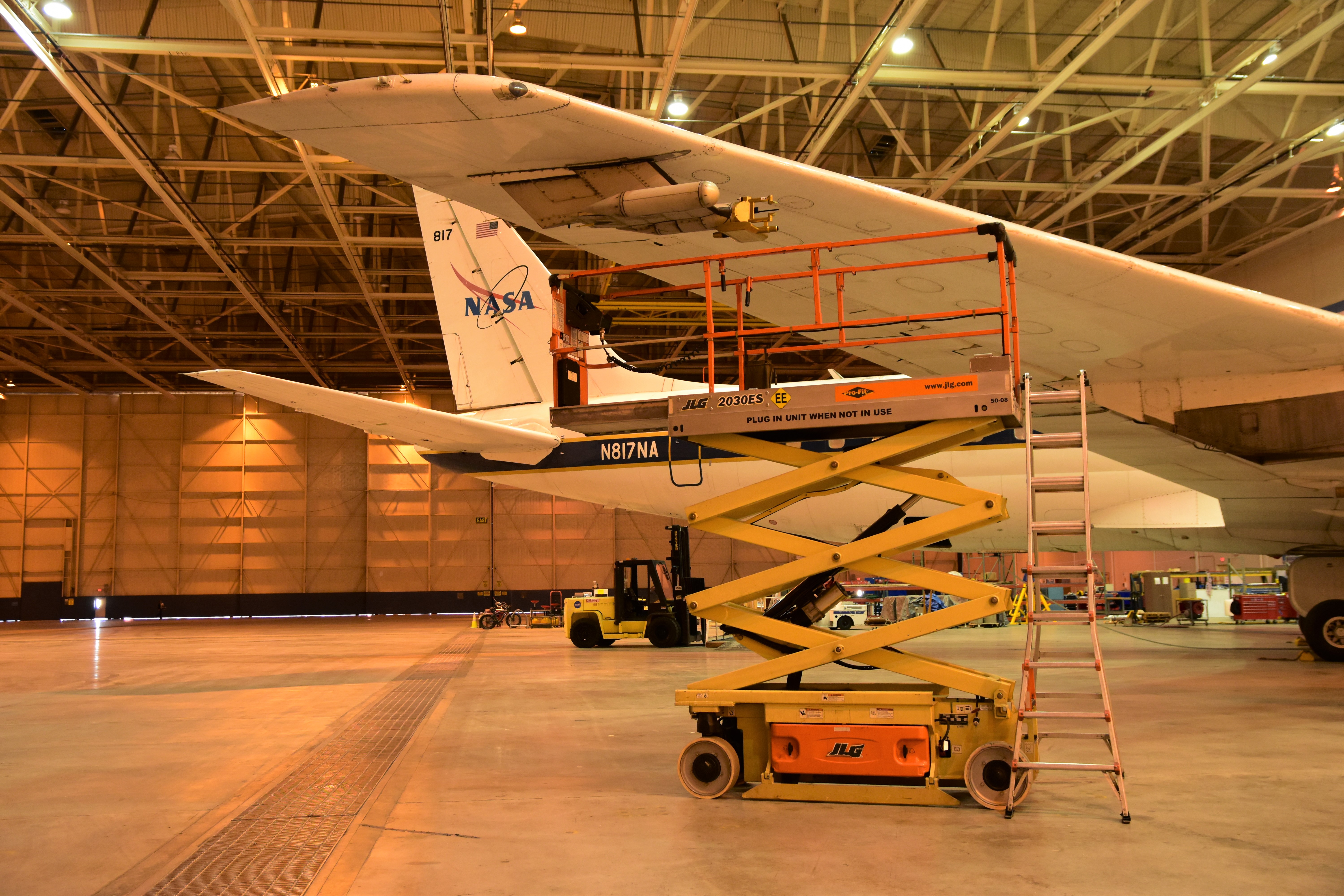
A lift and/or ladder is necessary to access the CAPS
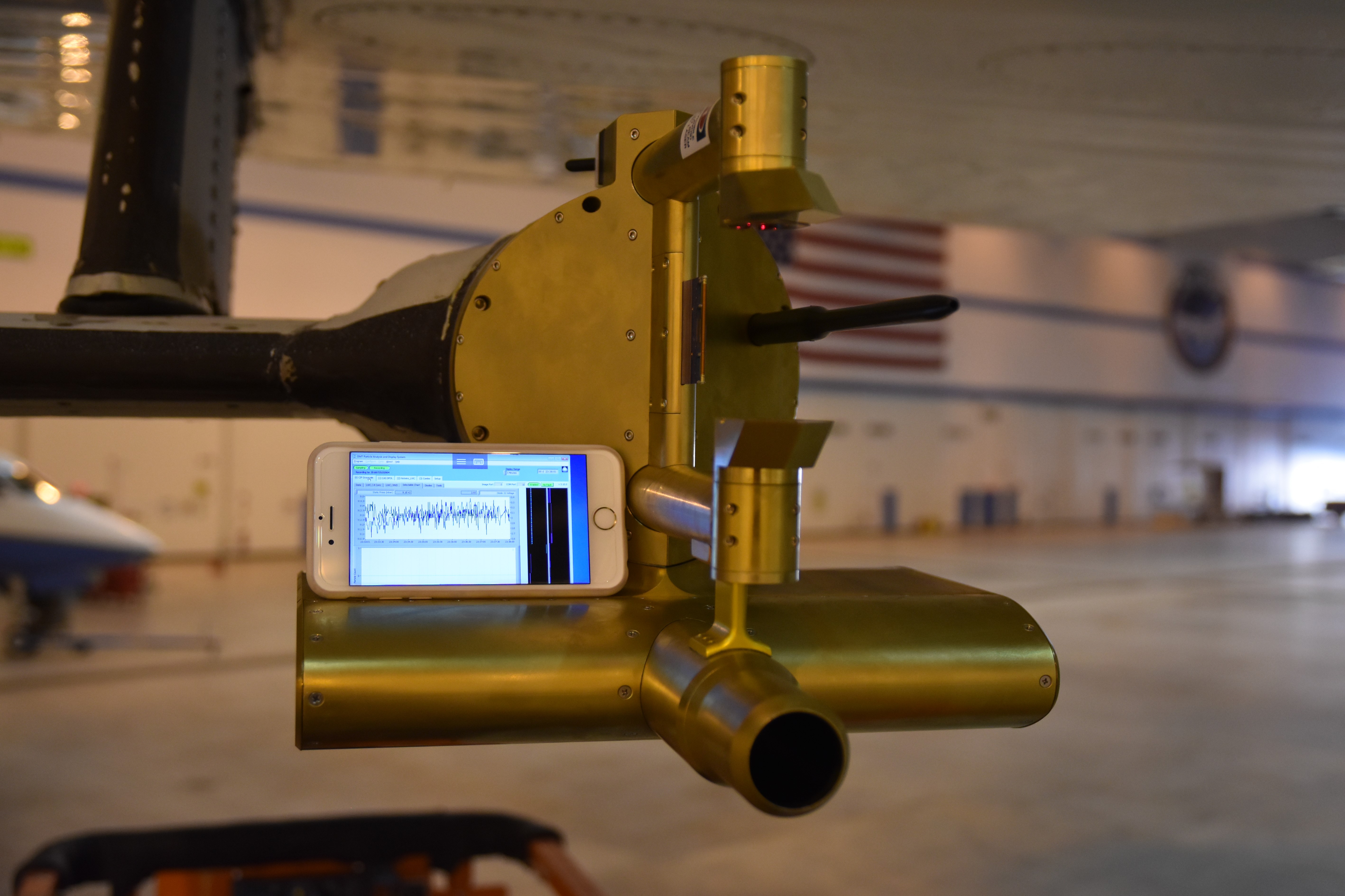
Controlling the CAPS remotely with a mobile phone
24 July 2016: Back to the aircraft
After 9 days in Colorado, we are back to Palmdale, California. The transfer from Los Angeles airport to Palmdale took more than 3 hours because several roads were closed due to the presence of heavy bushfires. Only a few things need to be prepared before we are ready for the “equator flight” on 28 July.
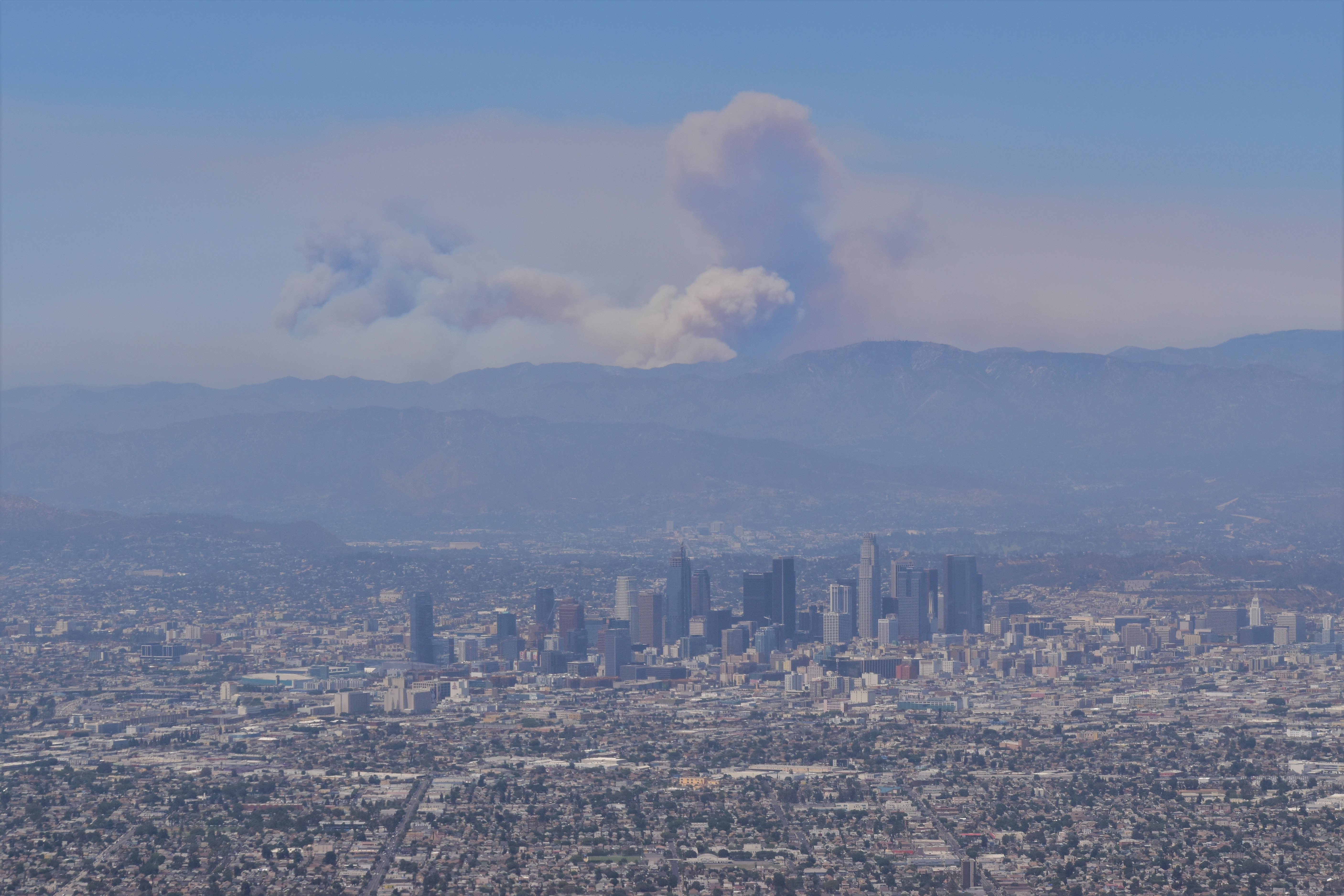
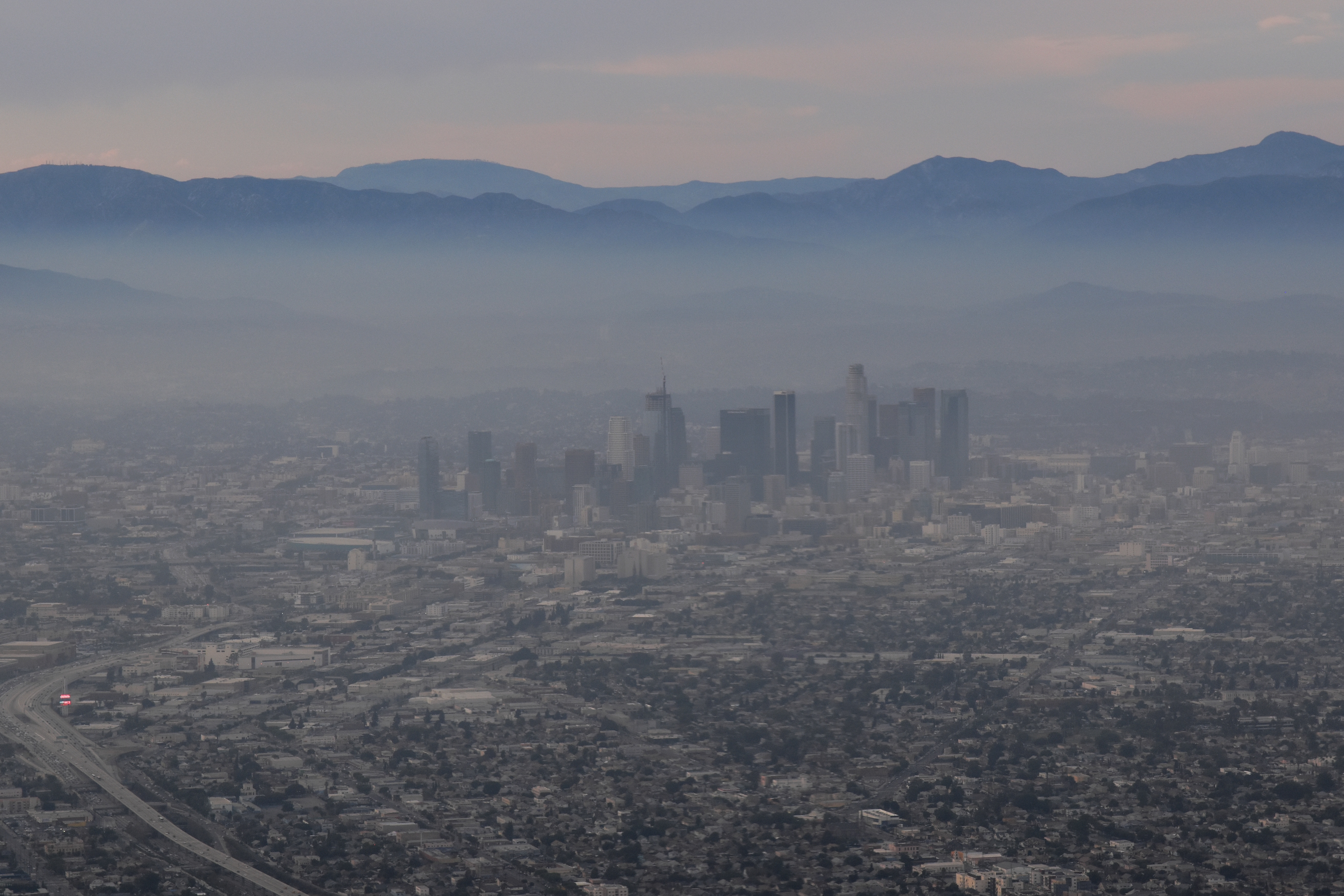
The fires near L.A. look like a volcanic eruption
Visibility underneath the smoke plume is rather poor
23 July 2016: A thunderstorm a day
The mid-west is known for regular showers and thunderstorms in the summer season. Since we arrived in Boulder, we could set our clock for the daily thunderstorm every afternoon.
21 July 2016: Why, how, and so what?
In our first article at uni:view, we give an overview of our measurements during ATom, summarize the scientific objectives, and give reasons why one should care about (coarse mode) aerosols.
15 July 2016: Change of scene
From 15-23 July, the so-called “problem resolution period” has been scheduled as part of ATom. This period allows scientists and aircraft crew to resolve issues observed during the shakedown flight and the test flight. We take the opportunity to meet the manufacturer of the CAPS in Boulder, Colorado, work on software and discuss scientific questions with researchers at the National Oceanic and Atmospheric Administration (NOAA) and at the National Center for Atmospheric Research (NCAR).
Los Angeles airport

Flight from Los Angeles to Denver
14 July 2016: Software and data care
Currently, we are busy with writing software, analyzing the measurements from the test flight, preparing the preliminary results for the ATom data archive, and monitoring the CAPS performance. We are very pleased to see stable CAPS calibrations.
12 July 2016: Well-prepared – Asian dust for the first ATom test flight
After months of preparation, the first ATom test flight was carried out today. How could we better test the CAPS – if not under the presence of mineral dust? We were very lucky to find Asian dust, sea salt aerosol, and low-level clouds in our measurement area. The CAPS provided interesting coarse mode aerosol and cloud data in the size range between 0.5 µm and 930 µm particle diameter.
11 July 2016: Shakedown flight – passed with flying colors
Today, our CAPS had its maiden flight. In contrast to a normal flight, this flight was like a roller coaster. In fact, it was the test flight for the instrument mountings in- and outside the cabin. Only minimum crew, i.e. as few as possible crew members (pilots, technicians), were on board. Since nothing was shaken down, we are ready to go for the first test flight on 12 July.
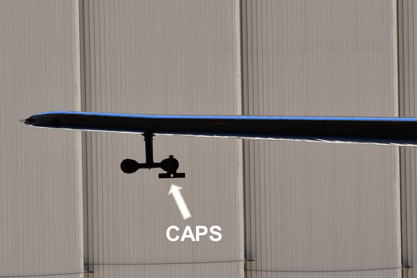
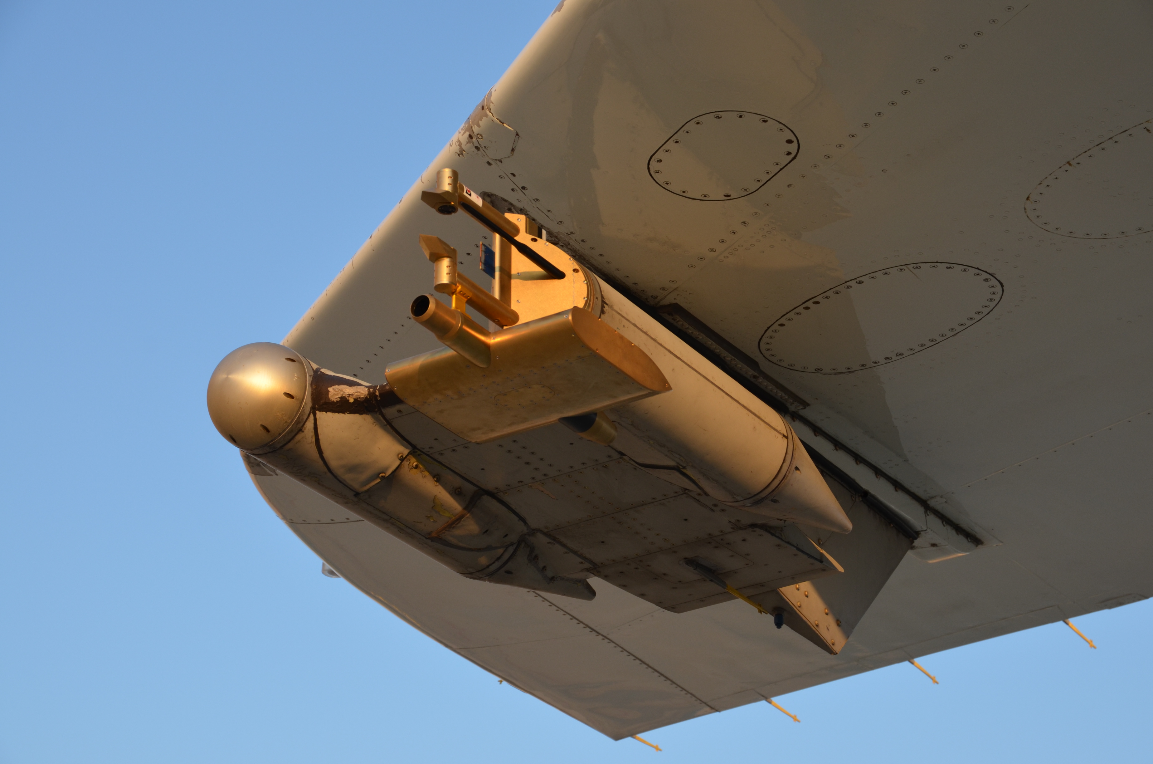
CAPS at the DC-8 wing
DC-8 during the shakedown flight
10 July 2016: Wildfire aerosol
Summer is wildfire season in the U.S. Currently several wildfires are burning in California. Their plumes are visible as greyish aerosol layers in the atmosphere over Palmdale.

Smoke from wildfires over Palmdale
7 July 2016: Weight watchers
Today, we had to install all our equipment into the DC-8 for the weight-and-balance check which is needed to determine the aircraft’s center of gravity. For safe flight, weight and center of gravity have to stay within certain limits. We are still allowed to bring additional components into the plane, but since the DC-8 is under “weight-control” every item added to or removed from the aircraft has to be weighed and registered.

DC-8 in the NASA hangar
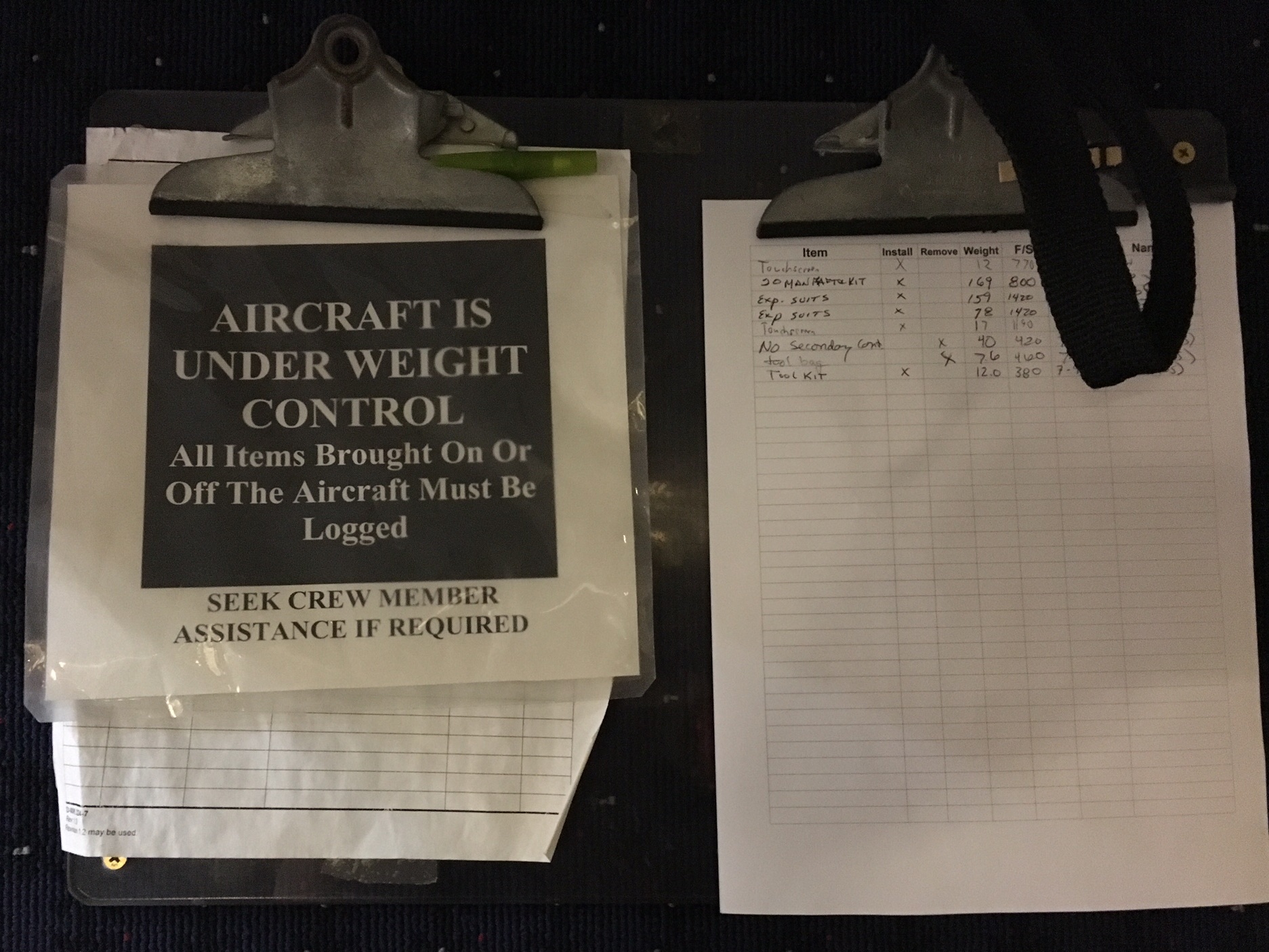
Weight control log
5 July 2016: Safety begins here
Every crew member flying on the DC-8 needs to receive flight medical clearance and is required to participate in the safety training. Compared to commercial airliners, the DC-8 has numerous additional safety features. We were trained to use the safety equipment available on the DC-8 and learned how to operate the emergency radios.
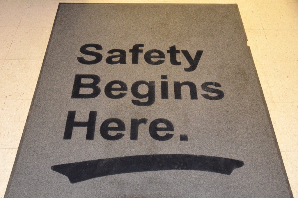
Carpet in the hangar

DC-8 cockpit
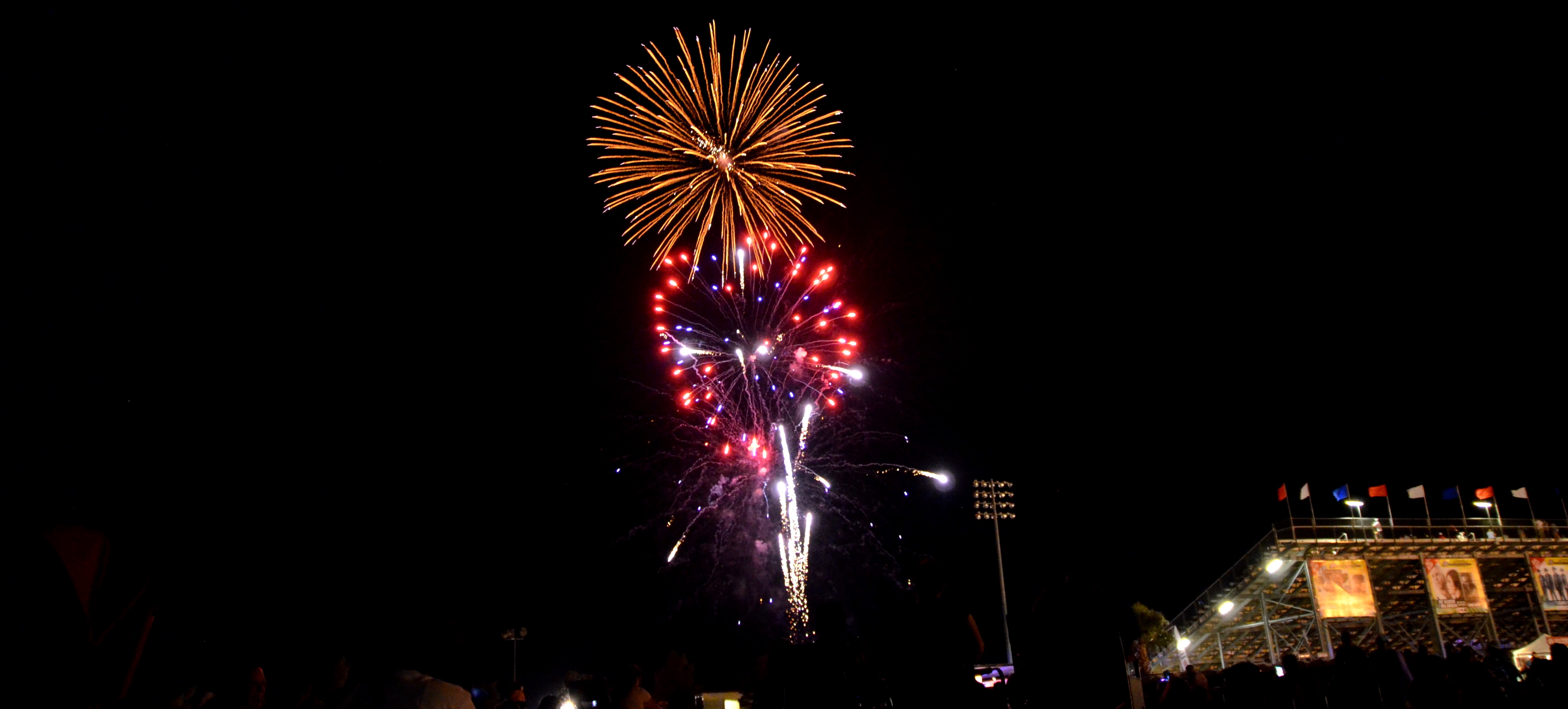
4 July 2016: Independence day
Today, we celebrated Fourth of July. After a nice barbecue with several ATom colleagues, we went to the festival area and watched the fireworks.


3 July 2016: Back into the future
Our schedule in the past few days included CAPS size calibration, testing remote communication with the instrument in the DC-8 and fixing hardware issues. The voltmeter, laser goggles, circuit diagrams and the soldering rod were our most important work equipment. In case, one needs electronic components, Fry’s Electronics at Burbank, about one hour driving from Palmdale, has got everything.
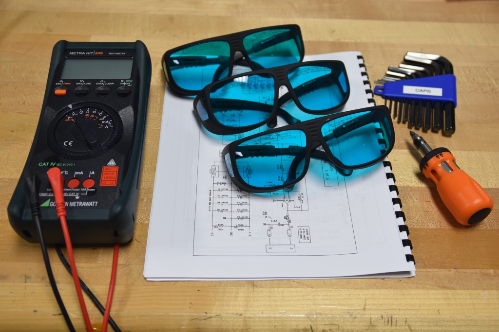
Voltmeter, laser goggles & circuit diagrams

CAPS on the work bench in the hangar
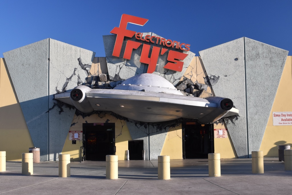
Fry's Electronics, Burbank (California)
1 July 2016: Once upon a time…
On our way to the aircraft hangar (left), we pass a museum with numerous exciting airplanes including one of two highly-modified B747 aircraft (right) which acted as space shuttle carriers. These B747 shuttle carrier aircraft were used to transport space shuttles back to Kennedy Space Center, Florida, if the space shuttles landed at alternate airports, e.g. at Palmdale, California.
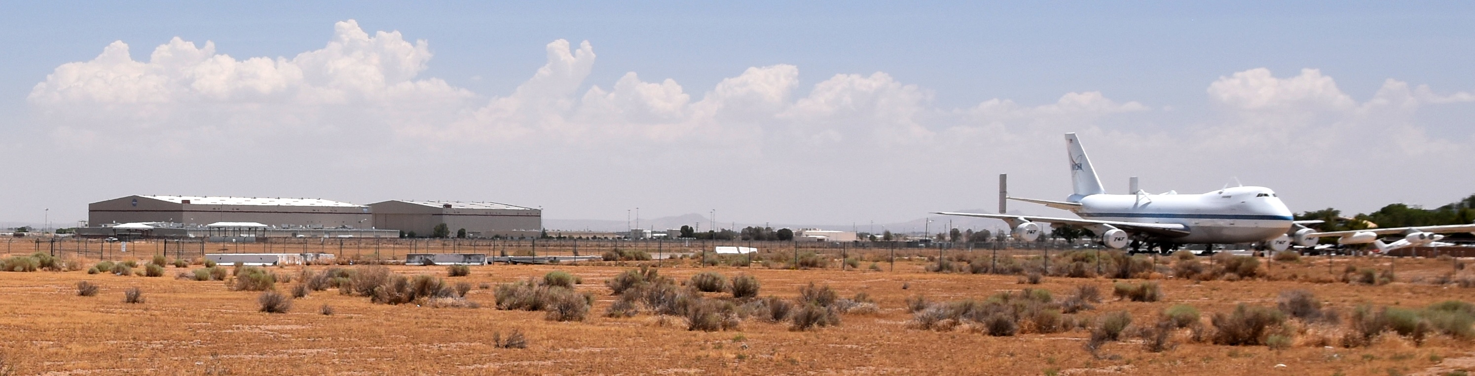
Aircraft hangar on the left, B747 shuttle carrier aircraft on the right
30 June 2016: A big step forward
After some challenges, we are happy to see the CAPS working in the canister at the right wing of the DC-8. Doesn’t it look pretty in the canister?!
Working CAPS
Canister
29 June 2016: The early bird catches the dust
On our daily way to the aircraft hangar, we drive through the hot desert and arrive at the main gate of Neil A. Armstrong Flight Research Center after 10-15 minutes of driving. Work starts between 6:30 and 7:30 a.m. Today, the atmospheric boundary layer was full of mineral dust. It would have been interesting to measure the dust size distribution with the CAPS.

Neil A. Armstrong Flight Research Center
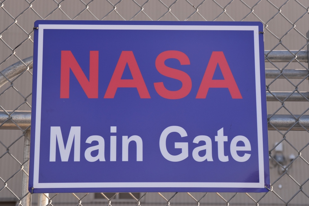
NASA Main Gate
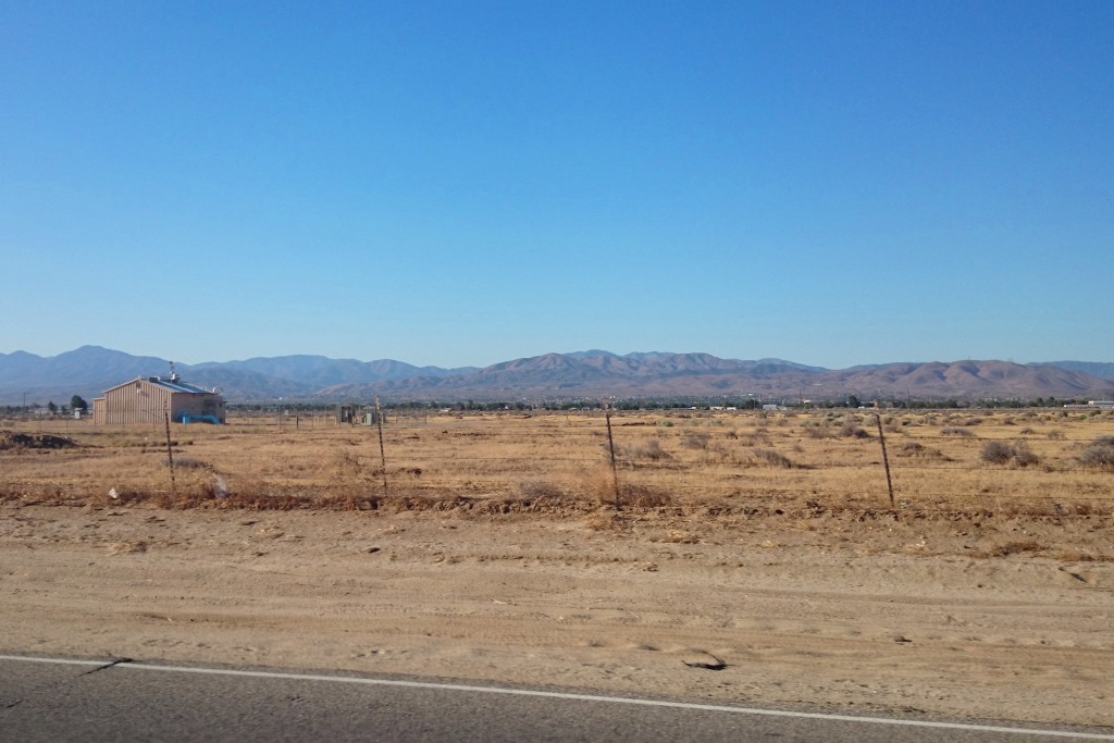
Mineral Dust in atmospheric boundary layer
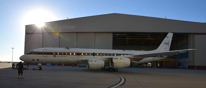
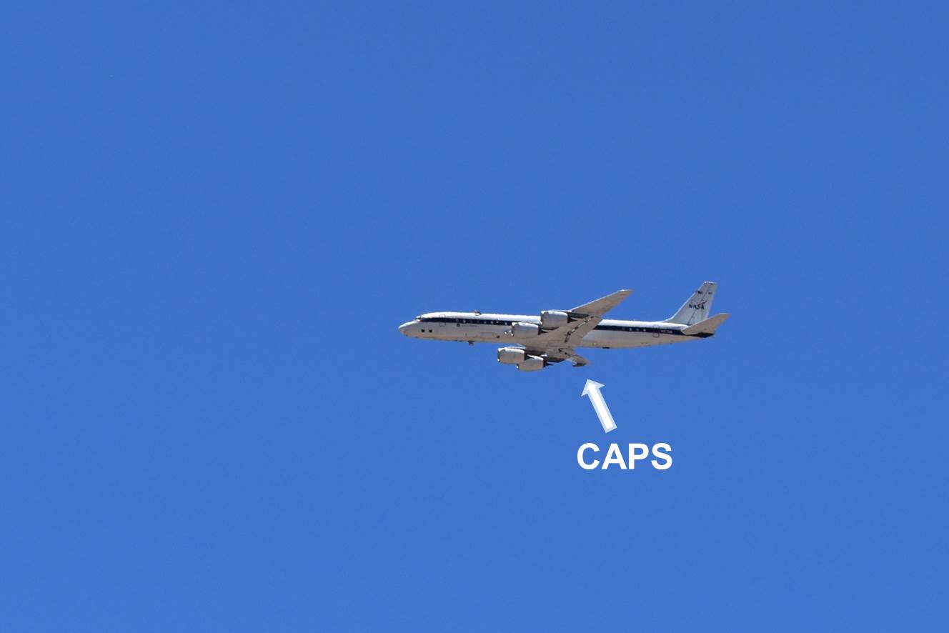
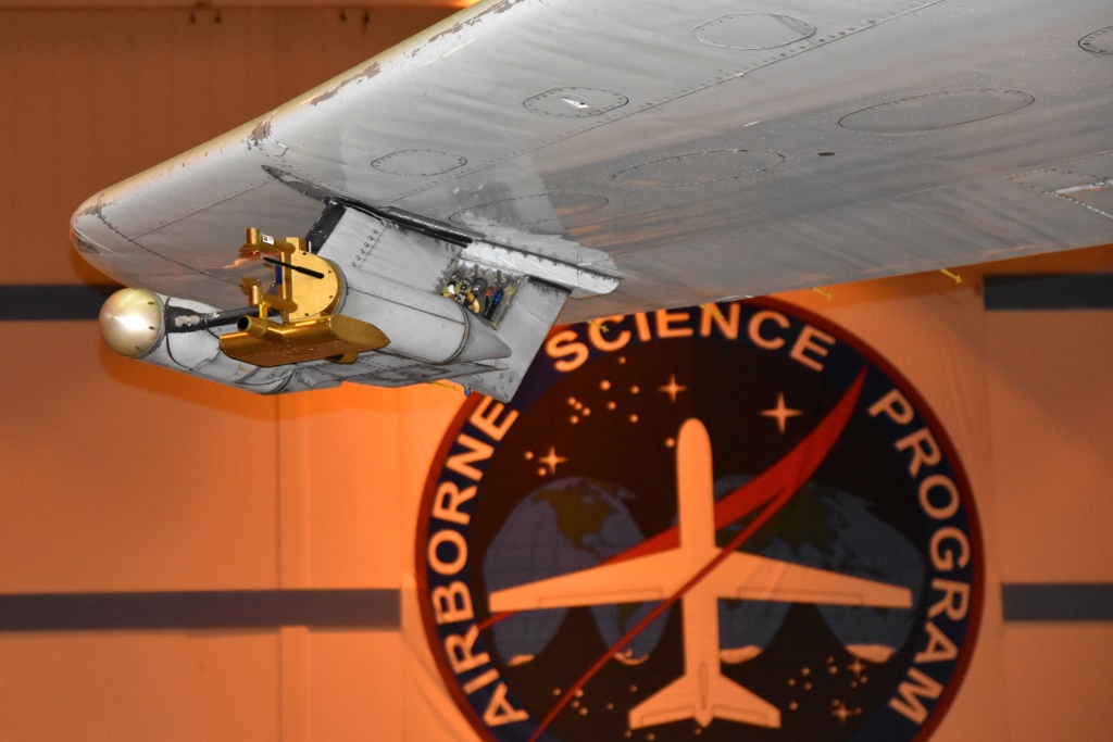
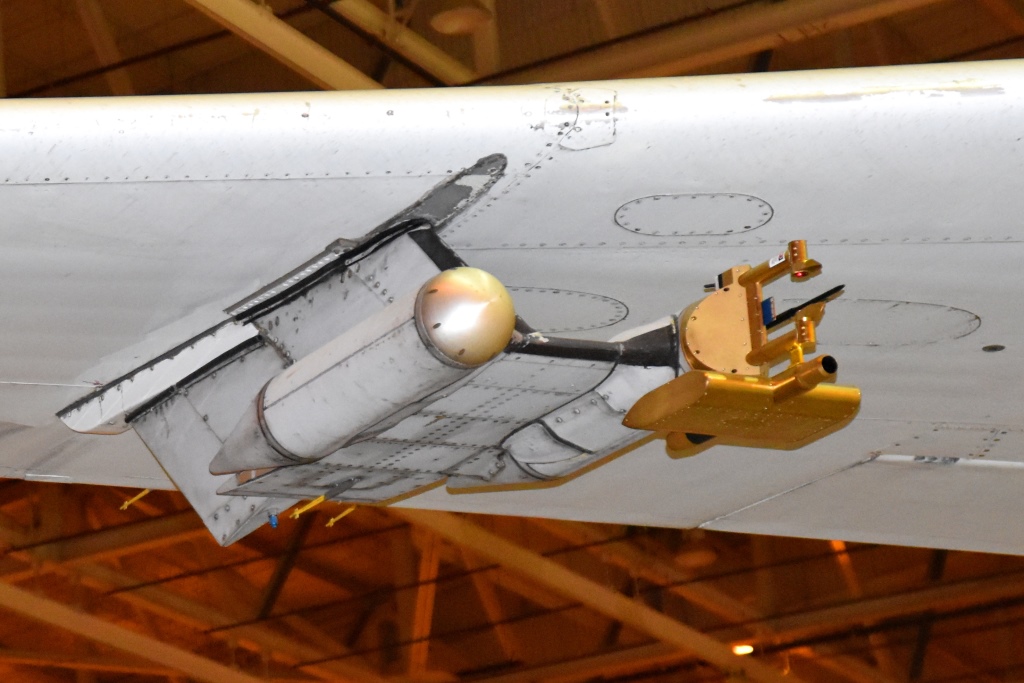
28 June 2016: The adventure begins
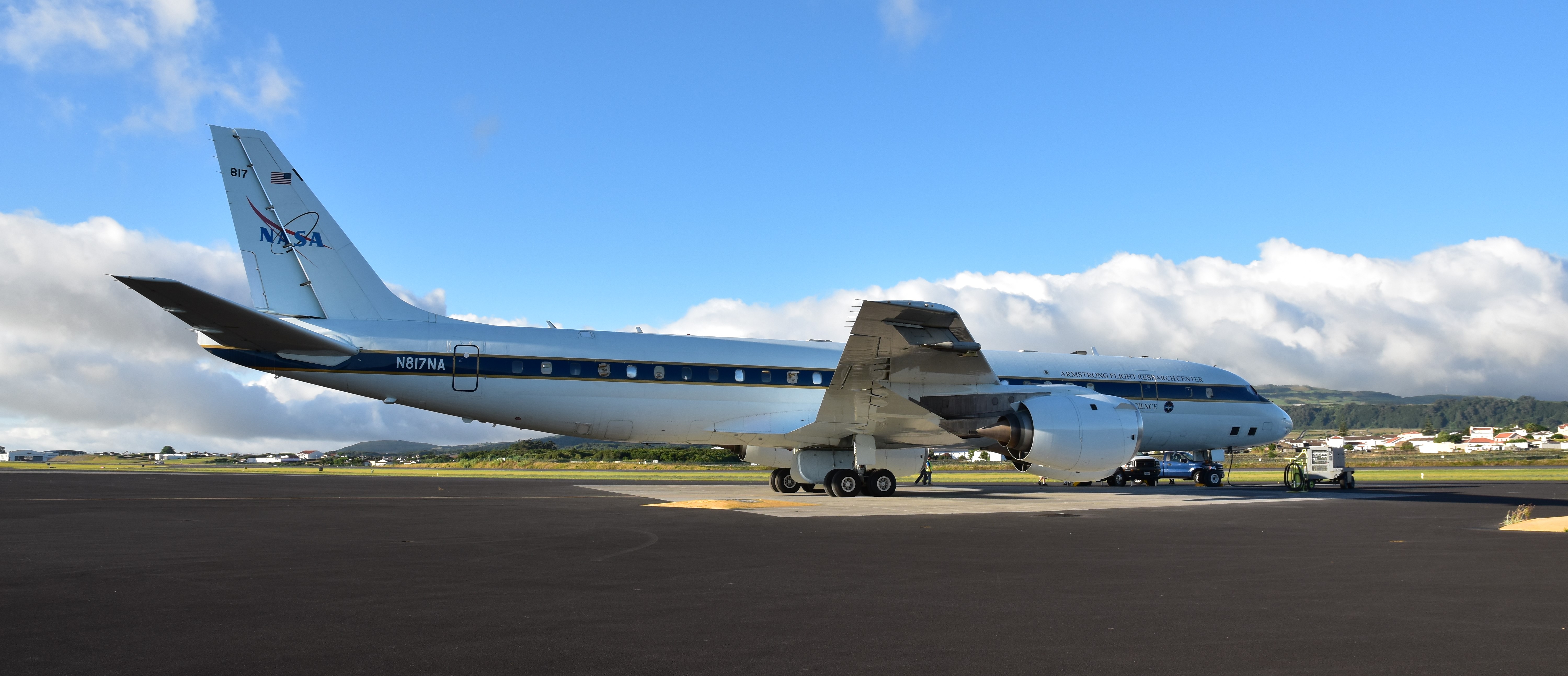
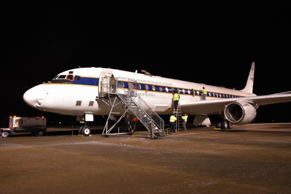
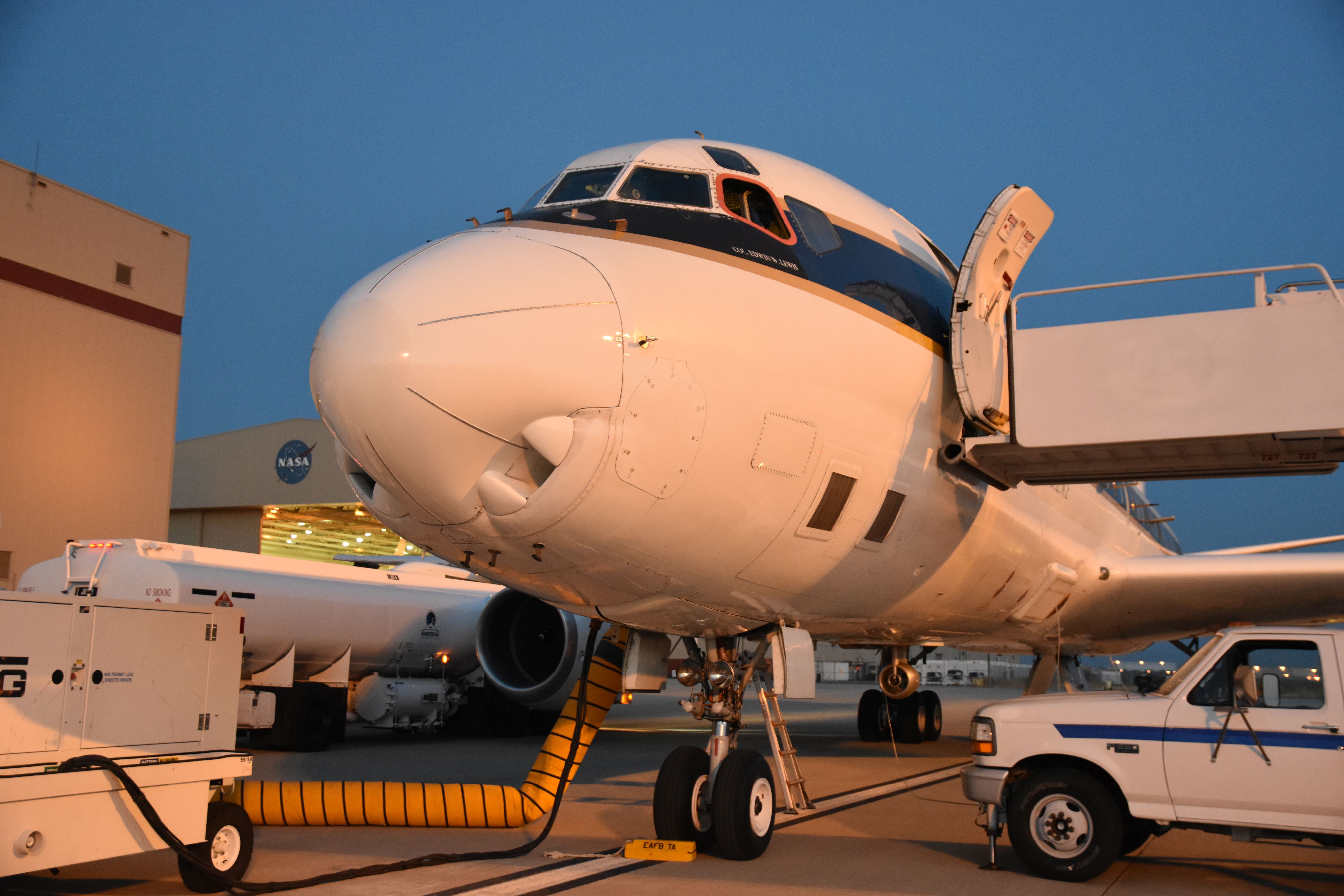
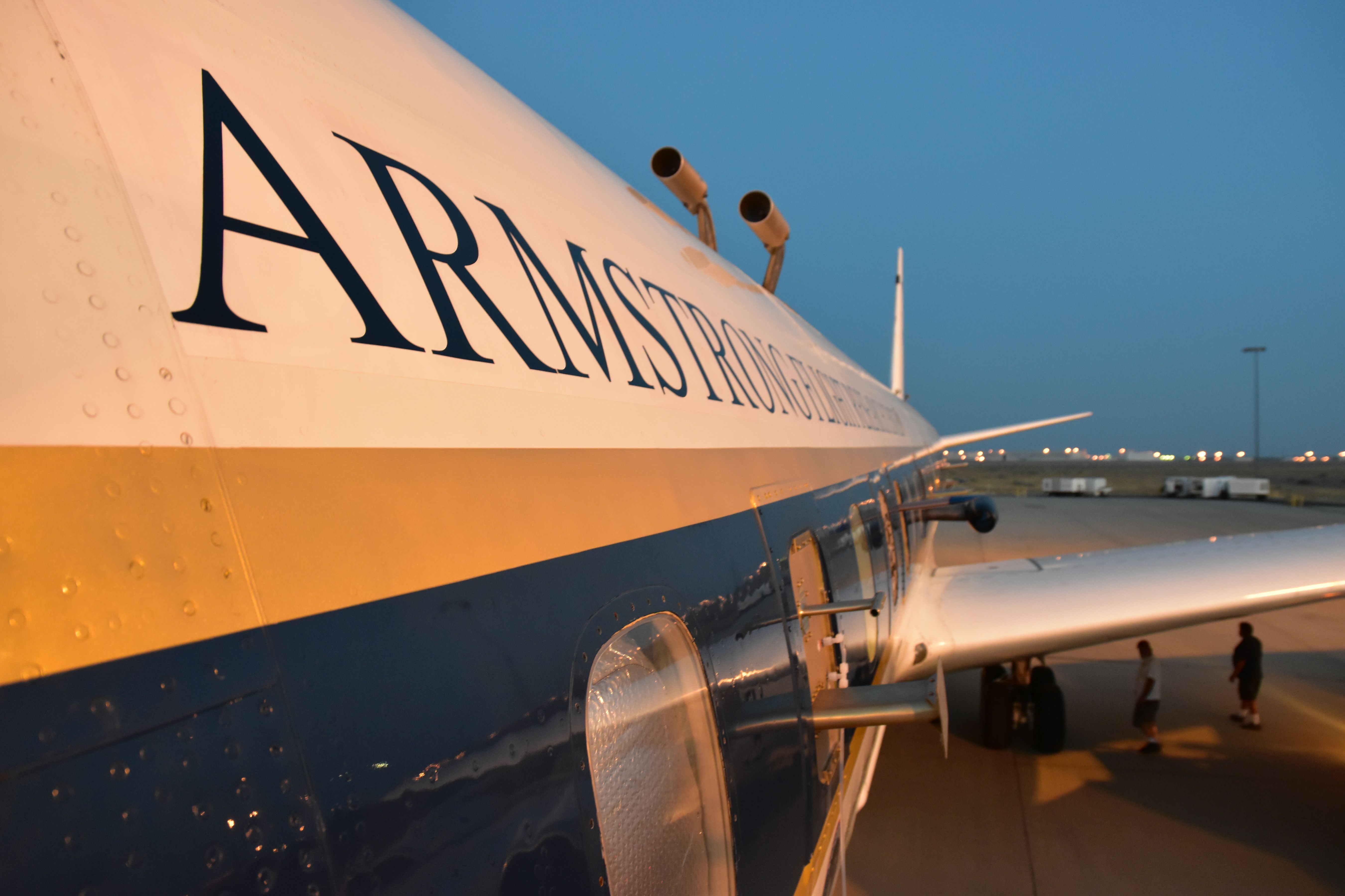
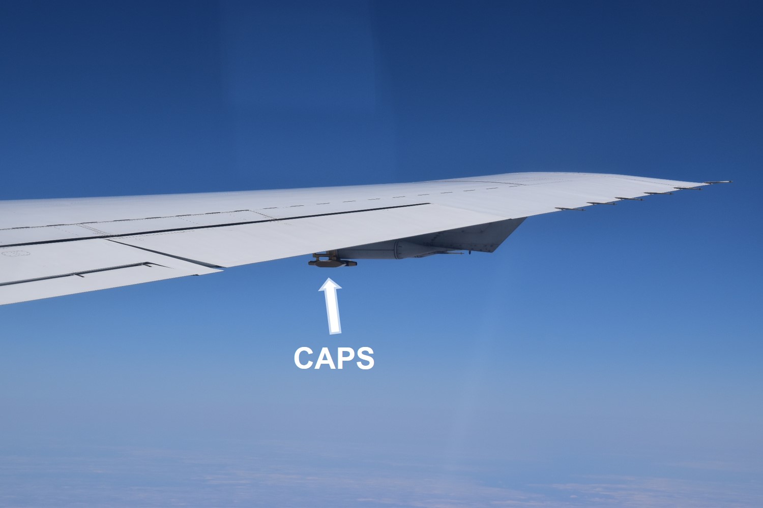
We (B. Weinzierl, M. Dollner, H. Schuh) arrived at Armstrong Flight Research Center, Palmdale (California) for the ATom Mission. During ATom, we will fly a Cloud, Aerosol, and Precipitation Spectrometer (CAPS) onboard the NASA research aircraft DC-8 to measure the size and concentration of coarse-mode (supermicron) aerosol particles. The NASA DC-8 research aircraft is pretty impressive (top & bottom left). Compared to the size of the aircraft, the mounting for the CAPS at the wing looks really tiny (bottom right).
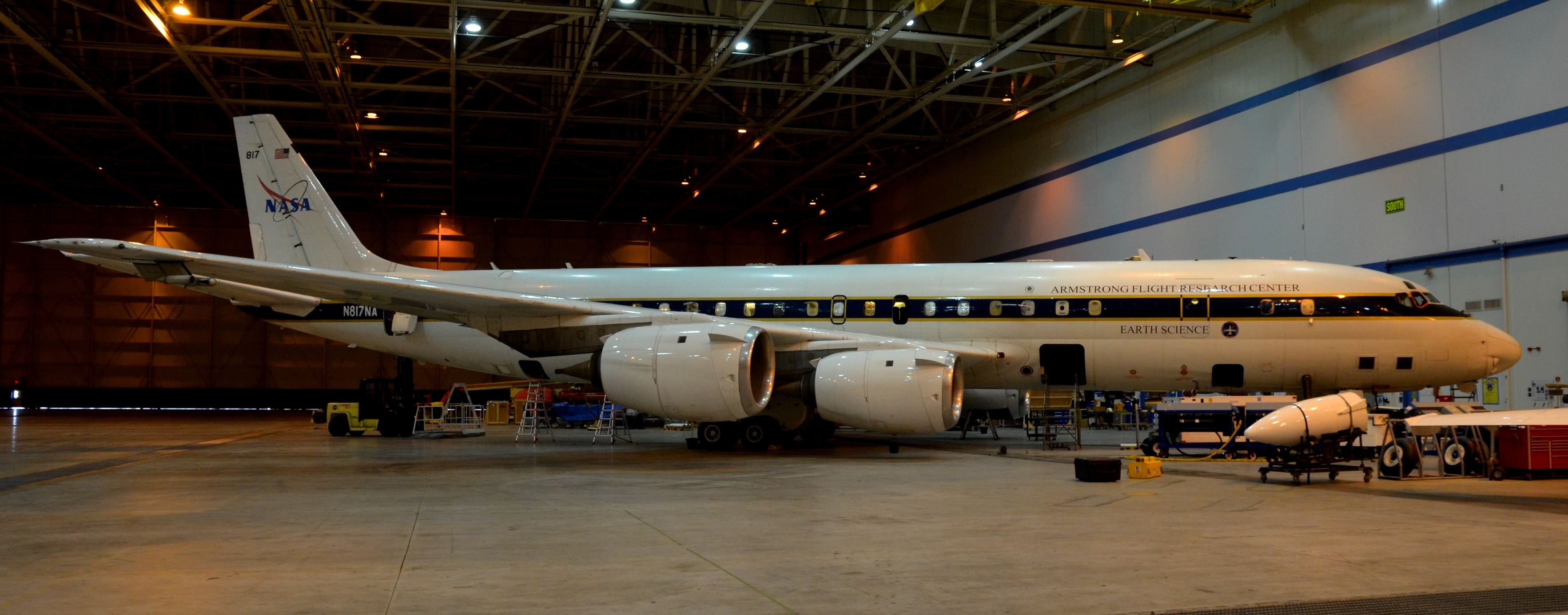
The NASA DC-8 research aircraft.
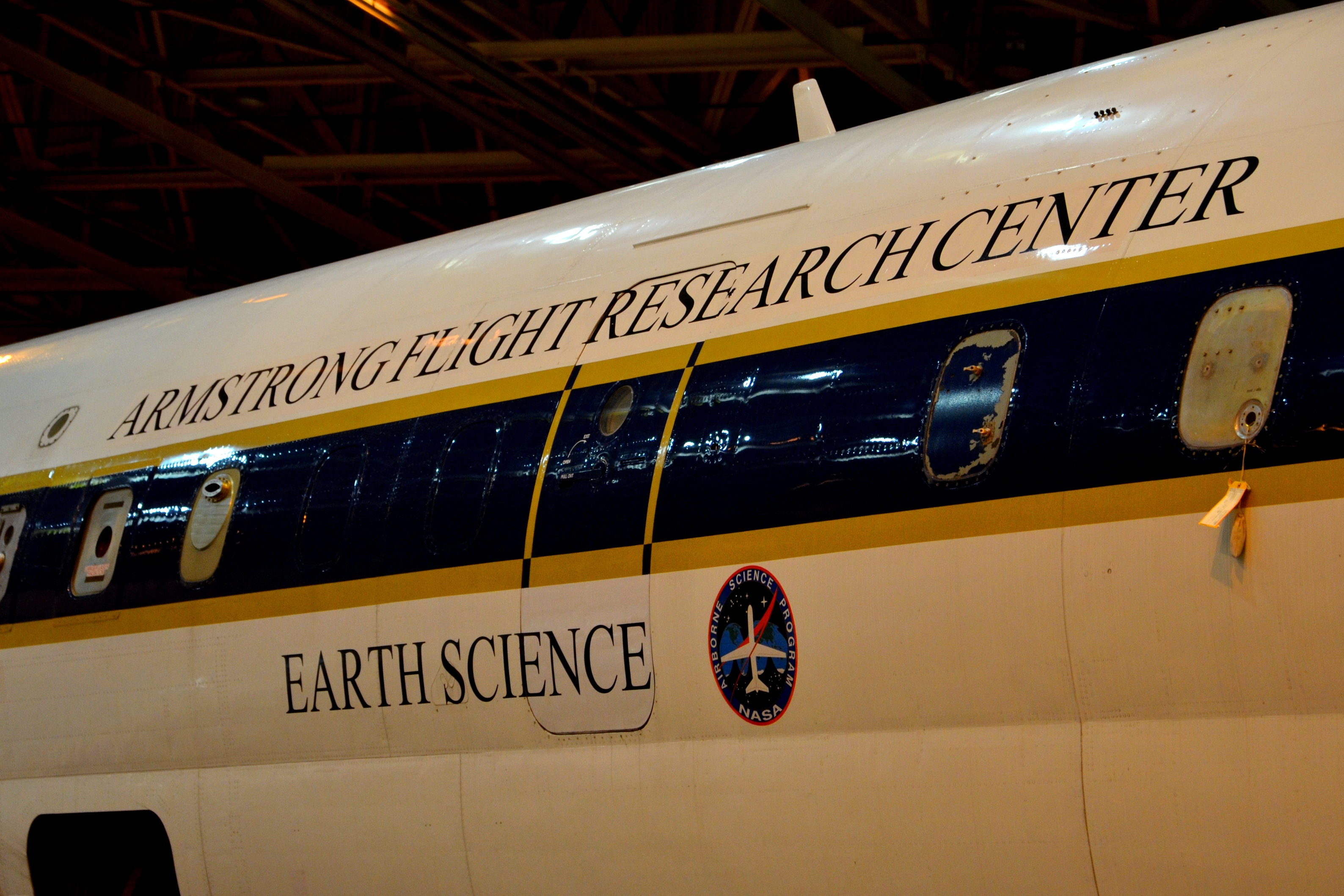
Armstrong Flight Research Center, Palmdale (California)

Mounting for the Cloud, Aerosol, and Precipitation Spectrometer (CAPS) at the wing
27 June 2016: Travelling from Europe to the U.S.
From Europe (top left), via the Arctic (top right) and Chicago (bottom left) to Los Angeles (bottom right).
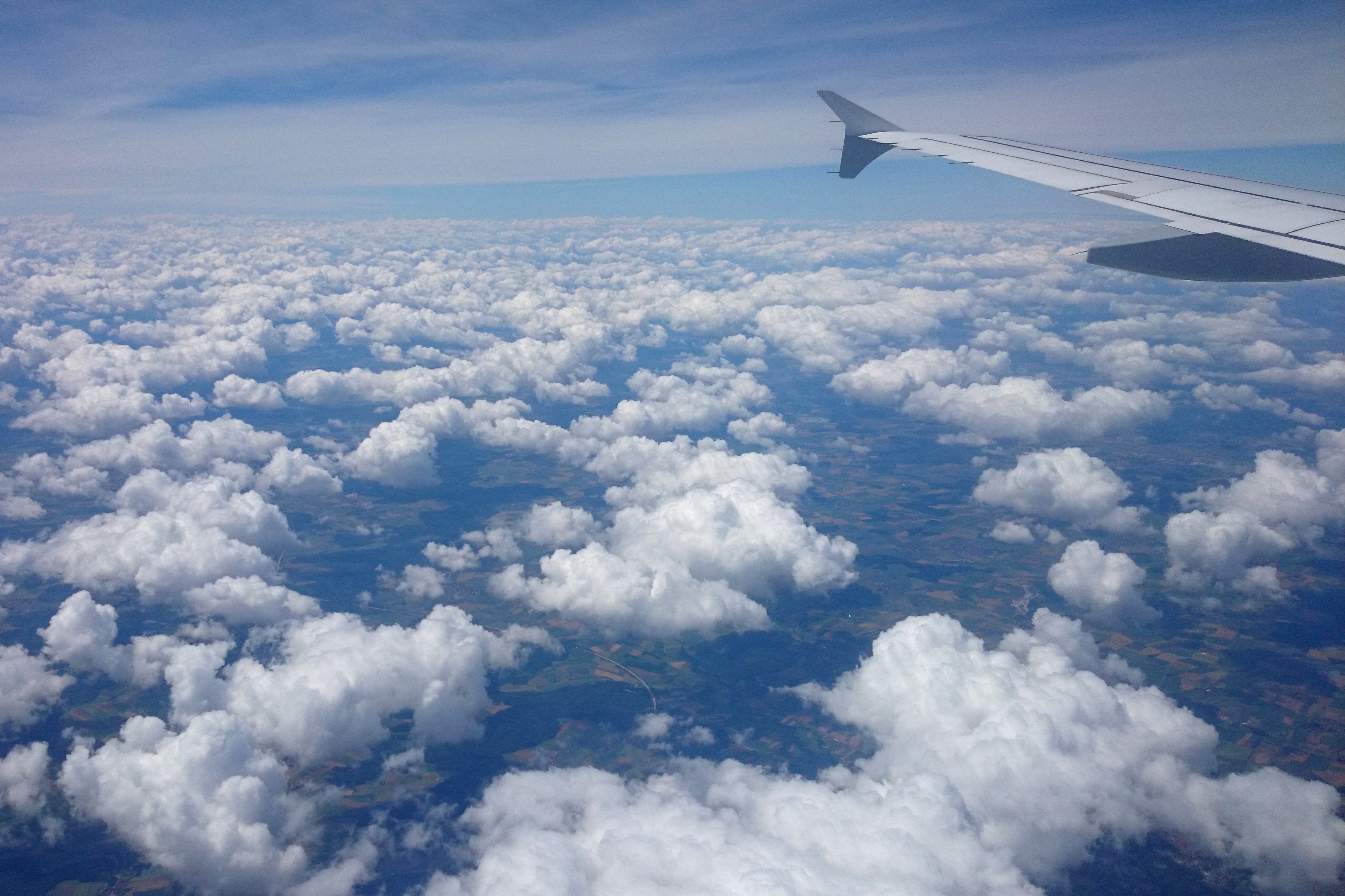
Europe
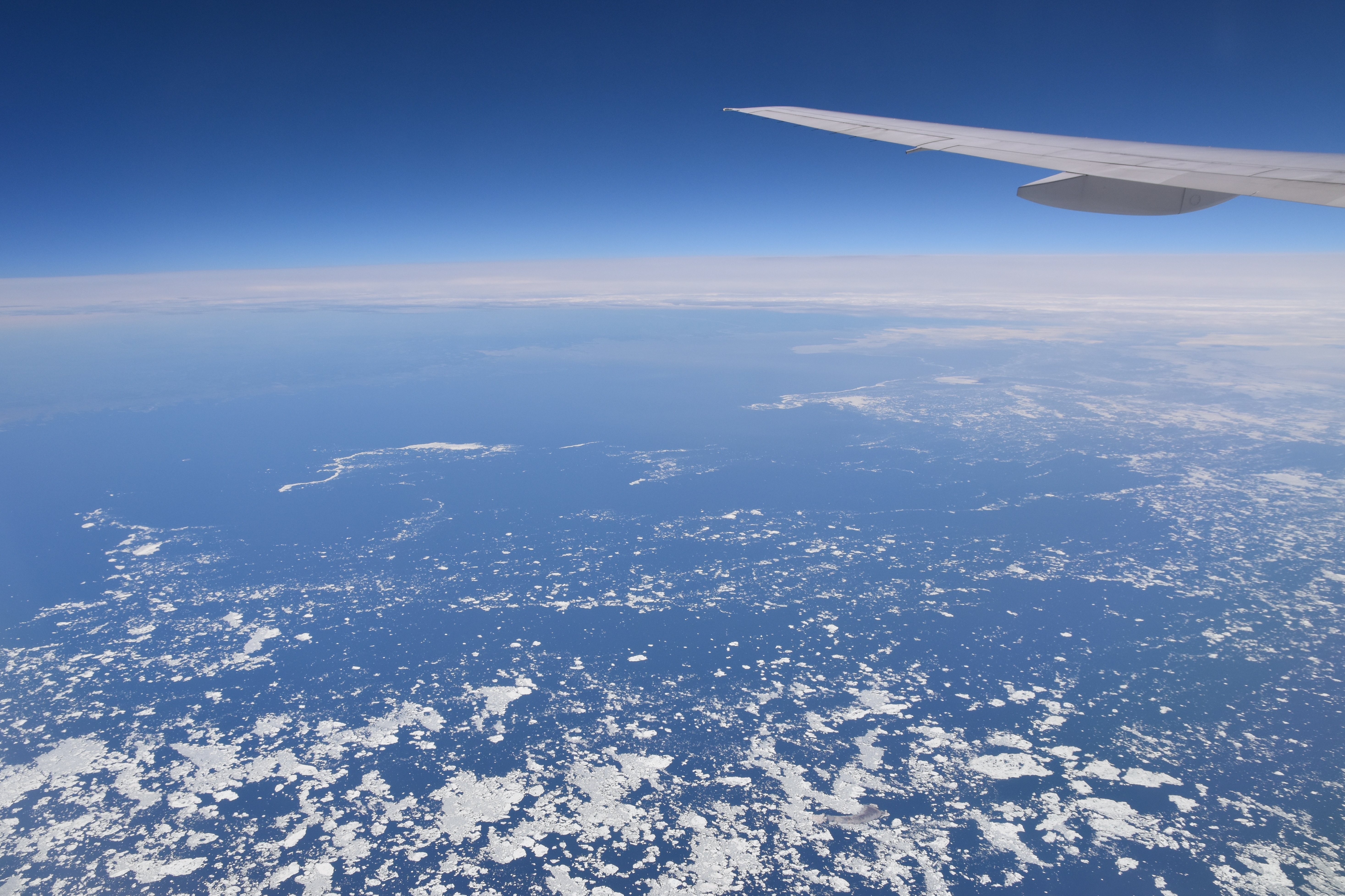
Arctic
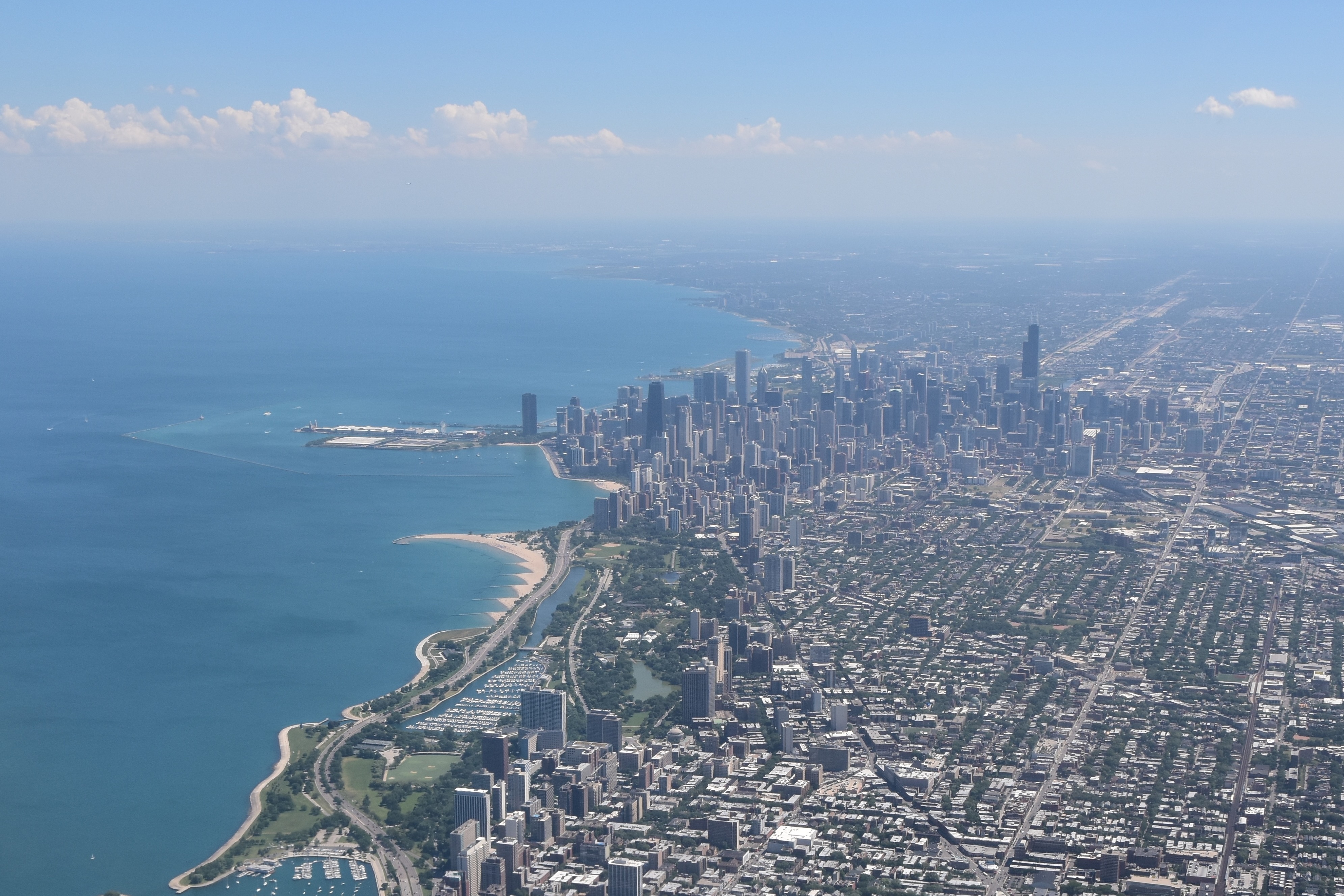
Chicago
Los Angeles
Contact: Univ.-Prof. Dr. Bernadett Weinzierl